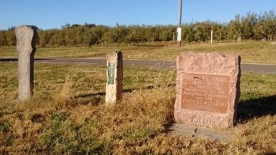
Near Dover in Lafayette County, Missouri — The American Midwest (Upper Plains)
Santa Fe Trail
1821 - 1872
— Tabo —
Erected 1909 by The Daughters of the American Revolution and the State of Missouri.
Topics and series. This historical marker is listed in this topic list: Roads & Vehicles. In addition, it is included in the Daughters of the American Revolution, and the Santa Fe Trail series lists. A significant historical year for this entry is 1821.
Location. 39° 11.391′ N, 93° 43.84′ W. Marker is near Dover, Missouri, in Lafayette County. Marker located west of Rasa Orchards. Touch for map. Marker is in this post office area: Dover MO 64022, United States of America. Touch for directions.
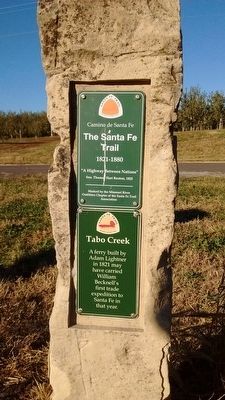
Other nearby markers. At least 8 other markers are within 7 miles of this marker, measured as the crow flies. Tabo Creek (here, next to this marker); a different marker also named Santa Fe Trail (approx. 2.1 miles away); Lion of Lucerne (approx. 6.3 miles away); Our Confederate Dead (approx. 6.3 miles away); Confederate States of America - National Flags (approx. 6.3 miles away); Confederate States of America - Battle Flags (approx. 6.3 miles away); Confederate Memorial State Historic Site (approx. 6.3 miles away); Confederate Home Chapel Restoration (approx. 6.3 miles away). Touch for a list and map of all markers in Dover.
Credits. This page was last revised on June 16, 2016. It was originally submitted on November 9, 2015, by Tom Bosse of Jefferson City, Tennessee. This page has been viewed 330 times since then and 20 times this year. Photos: 1, 2. submitted on November 9, 2015, by Tom Bosse of Jefferson City, Tennessee. • Bill Pfingsten was the editor who published this page.

