Near Evanston in Uinta County, Wyoming — The American West (Mountains)
Hilliard, Wyoming
Poverty Flats to Productive Ranches
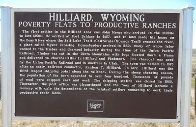
Photographed by Barry Swackhamer, September 10, 2015
1. Hilliard, Wyoming Marker
this page online
Erected by Wyoming State Archives and Historical Department.
Topics. This historical marker is listed in this topic list: Settlements & Settlers.
Location. 41° 8.364′ N, 110° 50.55′ W. Marker is near Evanston, Wyoming, in Uinta County. It is on State Highway 150 near County Route 166, on the left when traveling south. Touch for map. Marker is in this post office area: Evanston WY 82930, United States of America. Touch for directions.

Regionally, this marker is in Wyoming’s Uinta Mountains and in the Westward Expansion Trails Region. It is also in the American Mountain West. Globally, it is in North America, the Rocky Mountains, the Western Hemisphere, the Western World, and the Anglosphere. Historically, it finds itself in what was once Mexico’s Alta California.
Other nearby markers. At least 8 other markers are within 3 miles of this marker, measured as the crow flies: Hilliard City and Piedmont (a few steps from this marker); Bear River City (approx. 1.3 miles away); Aspen Tunnel (approx. 1.3 miles away); Transcontinental Railroad (approx. 1.3
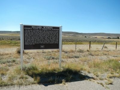
Photographed by Barry Swackhamer, September 10, 2015
2. Hilliard, Wyoming Marker
More about this marker. This marker, on the left when heading south, is located at a turn out on Highway 150 about 12 miles south of Interstate 80.
Credits. This page was last revised on June 16, 2016. It was originally submitted on November 10, 2015, by Barry Swackhamer of Brentwood, California. This page has been viewed 2,327 times since then and 162 times this year. Photos: 1, 2. submitted on November 10, 2015, by Barry Swackhamer of Brentwood, California.
