
Near Knoxville in Blount County, Tennessee — The American South (East South Central)
James Gillespy's Fort
Photographed by Tom Bosse, September 11, 2015
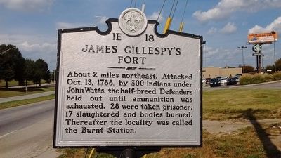
1. James Gillespy's Fort Marker
About 2 miles northeast. Attacked Oct. 13, 1788, by 300 Indians under John Watts, the half breed. Defenders held out until ammunition was exhausted. 28 were taken prisoner; 17 slaughtered and bodies burned. Thereafter the locality was called the Burnt Station.
Erected by Tennessee Historical Commission. (Marker Number 1E 18.)
Topics and series. This historical marker is listed in these topic lists: Forts and Castles • Settlements & Settlers. In addition, it is included in the Tennessee Historical Commission series list. A significant historical date for this entry is October 13, 1788.
Location. 35° 48.723′ N, 83° 58.992′ W. Marker is near Knoxville, Tennessee, in Blount County. It is at the intersection of Alcoa highway (Tennessee Route 129) and Cusick Road, on the right when traveling north on Alcoa highway. Touch for map. Marker is in this post office area: Alcoa TN 37701, United States of America. Touch for directions.

Regionally, this marker is in East Tennessee and in the Great Smoky Mountains. It is also in the American South, specifically in the Upper South, in Appalachia, and specifically in Southern Appalachia.
this page online
Other nearby markers. At least 8 other markers are within 2 miles of this marker, measured as the crow flies: The North Plant (approx. 0.3 miles away); Springbrook Park (approx. 0.9 miles away); Blount County's First Court (approx. one mile away); Springbrook School (approx. one mile away); Early Alcoa High School Athletics (approx. one mile away); Early Springbrook Home Construction (approx. one mile away); Hultquist and Chandler Homes (approx. 1.1 miles away); Hunt Field (approx. 1.2 miles away).
Photographed by Tom Bosse, September 11, 2015
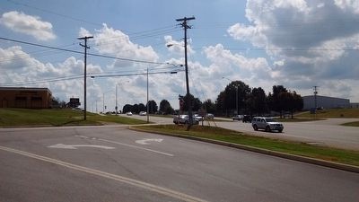
2. James Gillespy's Fort Marker
Credits. This page was last revised on October 4, 2018. It was originally submitted on November 10, 2015, by Tom Bosse of Jefferson City, Tennessee. This page has been viewed 1,891 times since then and 123 times this year. Photos: 1, 2. submitted on November 10, 2015, by Tom Bosse of Jefferson City, Tennessee. • Bill Pfingsten was the editor who published this page.
