Lovettsville in Loudoun County, Virginia — The American South (Mid-Atlantic)
Lovettsville in the Civil War
Union Gateway to Virginia
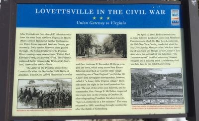
After Confederate Gen. Joseph E. Johnston withdrew his army from northern Virginia in March 1862 to defend Richmond, neither Confederate nor Union force occupied Loudoun County permanently. Both armies, however, often passed through. The Confederates' favorite Potomac River crossings were downstream: White's Ford, Edwards Ferry, and Rowser's Ford. The Federals preferred Berlin (present-day Brunswick), Maryland, three miles north of here.
The Army of the Potomac crossed into Lovettsville after the September 1862 Battle of Antietam. Union Gen. Alfred Pleasonton's cavalry and Gen. Ambrose E. Burnside's IX Corps occupied the town, which army nurse Sara Emma Edmonds described as "a pretty little village reminding one of New England," on October 26. A New York newspaper correspondent, however, called it "a dreary little Virginia village." Burnside spent the night in the hotel located on this spot. The rest of the army soon followed, and its commander, Gen. George B. McClellan, inspected his troops here on the evening of October 28, after telegraphing President Abraham Lincoln, "I go to Lovettsville in a few minutes." The army returned in 1863, marching through Lovettsville after the Battle of Gettysburg.
On April 21, 1865, Federal restrictions on trade between Loudoun County and Maryland Unionists were lifted. On May 3, in Lovettsville, the 25th New York Cavalry conducted what the New York Sunday Mercury called "the first hoisting of the Stars and Stripes in the County of Loudoun since the outbreak of the Rebellion." The "immense crowd" included returning Unionist refugees and a military band. A celebratory ball was held here in the hotel that evening.
Erected 2013 by Virginia Civil War Trails.
Topics and series. This historical marker is listed in this topic list: War, US Civil. In addition, it is included in the Virginia Civil War Trails series list. A significant historical date for this entry is October 26, 1862.
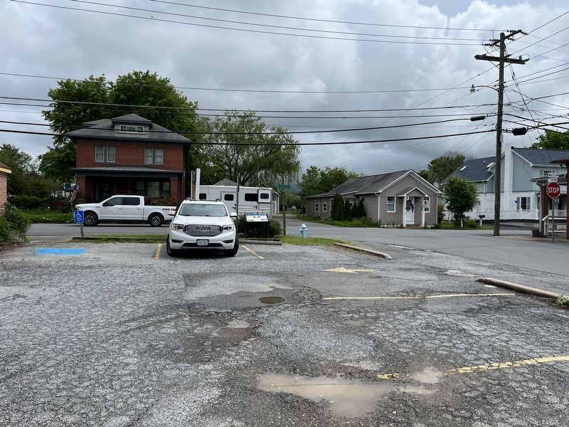
Location. 39° 16.362′ N, 77° 38.201′ W. Marker is in Lovettsville, Virginia, in Loudoun County. Marker is at the intersection of East Broad Way (County Route 673) and South Loudoun Street, on the right when traveling east on East Broad Way. Touch for map. Marker is at or near this postal address: 24 East Broad Way, Lovettsville VA 20180, United States of America. Touch for directions.
Other nearby markers. At least 8 other markers are within 3 miles of this marker, measured as the crow flies. St. James United Church of Christ (about 400 feet away, measured in a direct line); Veterans Memorial (approx. 0.2 miles away); The Independent Loudoun Rangers (approx. 0.2 miles away); First German Reformed Church Site and Cemetery (approx. 0.4 miles away); New Jerusalem Lutheran Church
Also see . . . Lovettsville Historical Society. The society aided with the content on and placement of the marker. (Submitted on November 12, 2015, by Craig Swain of Leesburg, Virginia.)
Credits. This page was last revised on May 15, 2022. It was originally submitted on November 12, 2015, by Craig Swain of Leesburg, Virginia. This page has been viewed 807 times since then and 57 times this year. Photos: 1. submitted on November 12, 2015, by Craig Swain of Leesburg, Virginia. 2. submitted on May 15, 2022, by Devry Becker Jones of Washington, District of Columbia.

