Afton in Lincoln County, Wyoming — The American West (Mountains)
Osmond
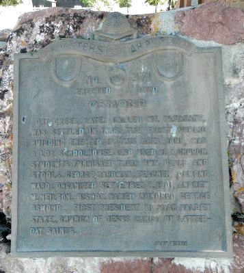
Photographed by Barry Swackhamer, September 11, 2015
1. Osmond Marker
Erected 1970 by Daughters of Utah Pioneers. (Marker Number 371.)
Topics and series. This historical marker is listed in these topic lists: Education • Religion & Religious Structures • Settlements & Settlers. In addition, it is included in the Daughters of Utah Pioneers series list.
Location. 42° 40.67′ N, 110° 55.993′ W. Marker is in Afton, Wyoming, in Lincoln County. It is on State Highway 241 near Dry Creek Road (County Route 146), on the right when traveling north. Touch for map. Marker is at or near this postal address: 2840 Wyoming Highway 241, Afton WY 83110, United States of America. Touch for directions.

Regionally, this marker is in the Westward
this page online
Other nearby markers. At least 8 other markers are within 12 miles of this marker, measured as the crow flies: Afton Wyoming (approx. 3.2 miles away); Mormons in Star Valley (approx. 3.4 miles away); Star Valley (approx. 3.4 miles away); Archibald Gardner (approx. 3.6 miles away); Lander Cut-off of the Oregon Trail (approx. 6.9 miles away); Lander Cut-Off of the Oregon Trail (approx. 9.4 miles away); Periodic Spring (approx. 11.9 miles away); Lander Cut-off (approx. 11.9 miles away). Touch for a list and map of all markers in Afton.
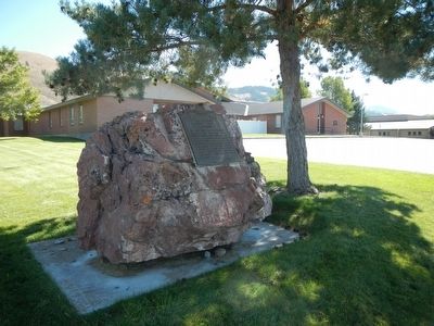
Photographed by Barry Swackhamer, September 11, 2015
2. Osmond Marker
Credits. This page was last revised on June 16, 2016. It was originally submitted on November 12, 2015, by Barry Swackhamer of Brentwood, California. This page has been viewed 611 times since then and 45 times this year. Photos: 1, 2. submitted on November 12, 2015, by Barry Swackhamer of Brentwood, California.
