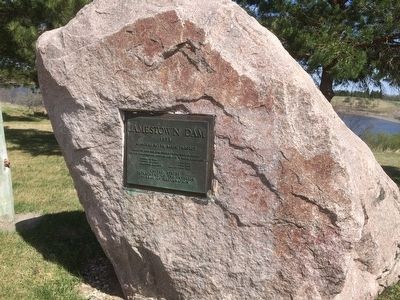
Near Jamestown in Stutsman County, North Dakota — The American Midwest (Upper Plains)
Jamestown Dam
Topics. This historical marker is listed in this topic list: Industry & Commerce. A significant historical year for this entry is 1953.
Location. 46° 55.928′ N, 98° 42.748′ W. Marker is near Jamestown, North Dakota, in Stutsman County. Marker is on 4th Ave. NW, 0.1 miles Jamestown Dam Rd., on the right when traveling north. The marker is located at a circular dirt pulloff just to the west of the dam. Touch for map. Marker is in this post office area: Jamestown ND 58401, United States of America. Touch for directions.
Other nearby markers. At least 8 other markers are within 2 miles of this marker, measured as the crow flies. Model 1861 8" Siege Howitzer (approx. 1.4 miles away); Fort Seward (approx. 1.4 miles away); Fort William H. Seward (approx. 1.4 miles away); a different marker also named Fort Seward (approx. 1˝ miles away); In Celebration of the Two Hundredth Year Birthday of the United States of America, 1976 (approx. 1.6 miles away); The Hansen Arts Park (approx. 1.7 miles away); Alton Klaus (approx. 1.9 miles away); Where the Two Rivers Meet (approx. 2 miles away). Touch for a list and map of all markers in Jamestown.
Credits. This page was last revised on June 16, 2016. It was originally submitted on November 13, 2015, by Ruth VanSteenwyk of Aberdeen, South Dakota. This page has been viewed 358 times since then and 9 times this year. Photo 1. submitted on November 13, 2015, by Ruth VanSteenwyk of Aberdeen, South Dakota. • Andrew Ruppenstein was the editor who published this page.
