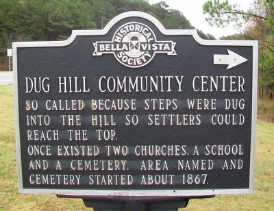
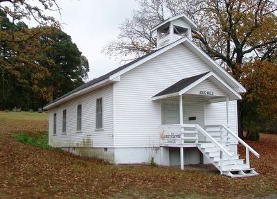
Dug Hill Community Center
So called because steps were dug into the hill so settlers could reach the top.
Once existed two churches, a school and a cemetery. Area named and cemetery started about 1867.
Erected 1981 by Bella Vista Historical Society.
Topics. This historical marker is listed in these topic lists: Cemeteries & Burial Sites • Churches & Religion • Education • Settlements & Settlers. A significant historical year for this entry is 1867.
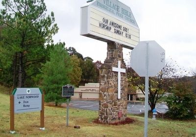
Location. 36° 28.536′ N, 94° 14.789′ W. Marker is in Bella Vista, Arkansas, in Benton County. Marker is at the intersection of Lancashire Boulevard (State Highway 340) and Town Center, on the right when traveling east on Lancashire Boulevard. Touch for map. Marker is at or near this postal address: 210 Town Center SE, Bella Vista AR 72714, United States of America. Touch for directions.
Other nearby markers. At least 8 other markers are within 3 miles of this marker, measured as the crow flies. The War Between the States (approx. 3.1 miles away); War with Spain (approx. 3.1 miles away); World War I (approx. 3.1 miles away); The Years Between (approx. 3.1 miles away); Triumph in Europe (approx. 3.1 miles away); Women in World War II (approx. 3.1 miles away); The Terrible Cost of World War II (approx. 3.1 miles away); World War II Home Front (approx. 3.1 miles away). Touch for a list and map of all markers in Bella Vista.
Credits. This page was last revised on August 16, 2020. It was originally submitted on November 14, 2015, by William Fischer, Jr. of Scranton, Pennsylvania. This page has been viewed 710 times since then and 56 times this year. Photos: 1, 2, 3. submitted on November 14, 2015, by William Fischer, Jr. of Scranton, Pennsylvania.


