Bank of Eureka Springs
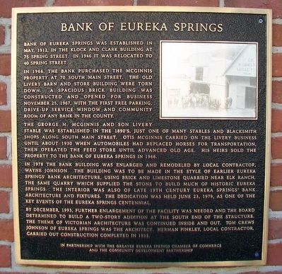
Bank of Eureka Springs was established in May, 1912, in the Klock and Clark Building at 75 Spring Street. In 1946 it was relocated to 40 Spring Street.
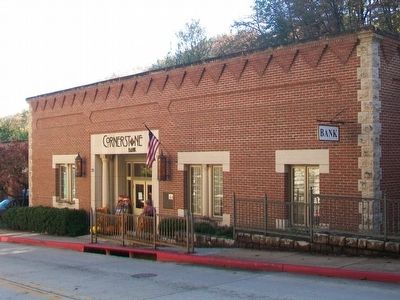
In 1966, the bank purchased the McGinnis property at 70 South Main Street. The old livery barn and store building were torn down. A spacious brick building was constructed and opened for business November 25, 1967, with the first free parking, drive-up window and community room of any bank in the county.
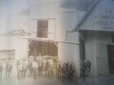
The George M. McGinnis and Son Livery Stable was established in the 1890's, just one of many stables and blacksmith shops along South Main Street. Otis McGinnis carried on the livery business until about 1930 when automobiles had replaced horses for transportation, then operated the feed store until advanced old age. His heirs sold the property to the Bank of Eureka Springs in 1966.
In 1978 the bank building was enlarged and remodeled by local contractor, Wayne Johnson. The building was to be made in the style of earlier Eureka Springs' bank architecture, using brick and limestone quarried near Elk Ranch, the same quarry which supplied the stone to build much of historic Eureka Springs. The interior was also of late 19th century Eureka Springs' bank architecture and fixtures. The dedication was held June 23, 1979, as one of the key events of the Eureka Springs centennial.
By
December, 1993, further enlargement of the facility was needed and the board determined to build a two-story addition at the south end of the structure. The theme of Victorian architecture was continued inside and out. Tom Crews Johnson of Eureka Springs was the architect. Herman Pinkley, local contractor, carried out construction completed in 1995.Erected by Greater Eureka Springs Chamber of Commerce and the Community Development Partnership.
Topics. This historical marker is listed in this topic list: Industry & Commerce. A significant historical month for this entry is May 1912.
Location. 36° 24.009′ N, 93° 44.402′ W. Marker is in Eureka Springs, Arkansas, in Carroll County. Marker is on Main Street (State Highway 23) north of Armstrong, on the right when traveling north. Touch for map. Marker is at or near this postal address: 70 South Main Street, Eureka Springs AR 72632, United States of America. Touch for directions.
Other nearby markers. At least 8 other markers are within walking distance of this marker. 85 South Main Street (within shouting distance of this marker); Bank of Eureka Springs Community Room (within shouting distance of this marker); Calif Spring (about 400 feet away, measured in a direct line); Eureka Springs Historical Museum (about 400 feet away); The Western District Courthouse (about 400 feet away); The Civic Center (about 500 feet away); Civil War Healing (about 700 feet away); Chandler Mall Buildings (about 800 feet away). Touch for a list and map of all markers in Eureka Springs.
Also see . . .
1. City of Eureka Springs. (Submitted on November 15, 2015, by William Fischer, Jr. of Scranton, Pennsylvania.)
2. Eureka Springs History. (Submitted on November 18, 2015, by William Fischer, Jr. of Scranton, Pennsylvania.)
Credits. This page was last revised on August 16, 2020. It was originally submitted on November 14, 2015, by William Fischer, Jr. of Scranton, Pennsylvania. This page has been viewed 424 times since then and 44 times this year. Photos: 1, 2, 3. submitted on November 15, 2015, by William Fischer, Jr. of Scranton, Pennsylvania.


