Plymouth in Naugatuck Valley Region, Connecticut — The American Northeast (New England)
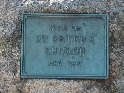
Site Of St. Peter’s Church
Photographed by Michael Herrick, November 16, 2015
1. Site Of St. Peter’s Church Marker
St. Peter’s
Church
1796 - 1915
(panel next to the marker)
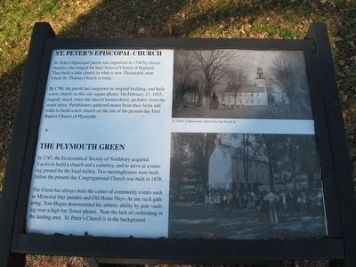
St. Peter’s Episcopal Church
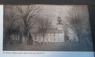
St. Peter's Episcopal parish was organized in 1740 by eleven families who longed for their beloved Church of England. They built a little church in what is now Thomaston, near where St. Thomas Church is today. By 1796, the parish had outgrown its original building, and built a new church on this site (upper photo). On February 27, 1915, tragedy struck when the church burned down, probably from the wood stove. Parishioners gathered stones from their fields and walls to build a new church on the site of the present day First Baptist Church of Plymouth.
The Plymouth Green
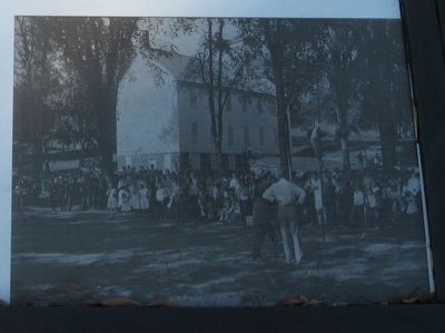
In 1747, the Ecclesiastical Society of Northbury acquired 4 acres to build a church and a cemetery, and to serve as a training ground for the local militia. Two meetinghouses were built before the present day Congregational Church was built in 1838. The Green has always been the center of community events such as Memorial Day parades and old Home Days. At one such gathering, Tom Hogan demonstrated his athletic ability by pole vaulting over a high
this page online
Topics. This historical marker is listed in this topic list: Religion & Religious Structures.
Location. 41° 40.389′ N, 73° 3.204′ W. Marker is in Plymouth in Naugatuck Valley Region, Connecticut. It is at the intersection of North Street and Park Street, on the left when traveling north on North Street. Located at the northeastern corner of the Plymouth Green. Touch for map. Marker is in this post office area: Plymouth CT 06782, United States of America. Touch for directions.

Regionally, this marker is in the Berkshire Foothills and in the Litchfield Hills. It is also in the American Northeast and in New England. Globally, it is in North America, the Western Hemisphere, the Western World, and the Anglosphere. Historically, it finds itself in what was once Litchfield County and also one of the original Thirteen Colonies.
Other nearby markers. At least 8 other markers are within walking distance of this marker: Plymouth Burying Ground (within shouting distance of
Photographed by Michael Herrick, November 16, 2015
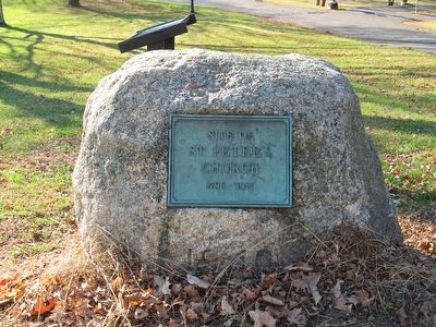
2. Site Of St. Peter’s Church Marker
Also see . . . Walking Tour of Plymouth Center. Town website entry (PDF) (Submitted on April 5, 2024, by Larry Gertner of New York, New York.)
Photographed by Michael Herrick, November 16, 2015
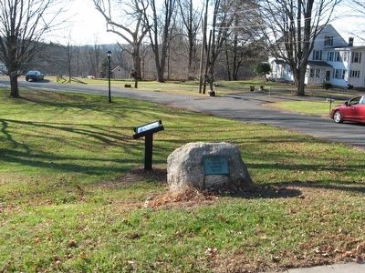
3. Site Of St. Peter’s Church Marker
Photographed by Michael Herrick, November 16, 2015
4. Site Of St. Peter’s Church Marker
Photographed by Michael Herrick, November 16, 2015
5. St. Peter's Episcopal Church facing North St.
Photographed by Michael Herrick, November 16, 2015
6. St. Peter’s Church and the Plymouth Green
Credits. This page was last revised on May 19, 2026. It was originally submitted on November 18, 2015, by Michael Herrick of Southbury, Connecticut. This page has been viewed 524 times since then and 31 times this year. Photos: 1, 2, 3, 4, 5, 6. submitted on November 18, 2015, by Michael Herrick of Southbury, Connecticut.
