Dungannon in Scott County, Virginia — The American South (Mid-Atlantic)
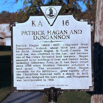
Patrick Hagan and Dungannon
Photographed by J. J. Prats, October 17, 2015
1. Patrick Hagan and Dungannon Marker
Erected 1993 by Department of Historic Resources. (Marker Number KA-16.)
Topics and series. This historical marker is listed in this topic list: Settlements & Settlers. In addition, it is included in the Virginia Department of Historic Resources (DHR) series list. A significant historical year for this entry is 1786.
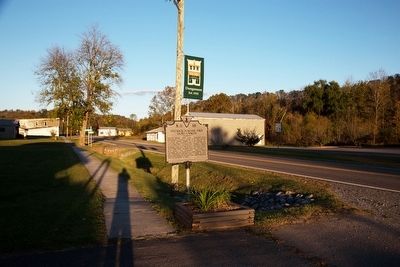
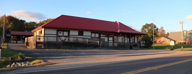
Location. 36° 49.654′ N, 82° 28.116′ W. Marker is in Dungannon, Virginia, in Scott County. It is on Virginia Route 65 west of Route 72, on the right when traveling west. It is at the former railroad depot. Touch for map. Marker
this page online

Regionally, this marker is in the Tri-Cities Area and in Southwest Virginia. It is also in the American South, specifically in the Upper South, in Appalachia, and specifically in Southern Appalachia. Globally, it is in North America, the Western Hemisphere, the Western World, and the Anglosphere. Historically, it finds itself in what was once the original Cherokee Nation, the territory of the Mississippian Culture, one of the original Thirteen Colonies, one of the Confederate States of America, and the Antebellum South.
Other nearby markers. At least 8 other markers are within 8 miles of this marker, measured as the crow flies: Flanary Archaeological Site (here, next to this marker); Dungannon Depot (a few steps from this marker); Patrick Porter (within shouting distance of this marker); Historic Bush Mill - The Building (approx. 5.3 miles away); Kilgore Fort House (approx. 6.6 miles away); Early Settlers in Russell County (approx. 7.7 miles away); Moore’s Fort (approx. 7.9 miles away); Coeburn (approx. 8 miles away). Touch for a list and map
Photographed by J. J. Prats, October 17, 2015
2. Patrick Hagan and Dungannon Marker
Photographed by J. J. Prats, October 17, 2015
3. Former Clinchfield Depot, Dungannon, Virginia
Credits. This page was last revised on June 16, 2016. It was originally submitted on November 25, 2015, by J. J. Prats of Powell, Ohio. This page has been viewed 2,156 times since then and 172 times this year. Photos: 1, 2, 3. submitted on November 25, 2015, by J. J. Prats of Powell, Ohio.
