Highlands/Perkins in Baton Rouge in East Baton Rouge Parish, Louisiana — The American South (West South Central)
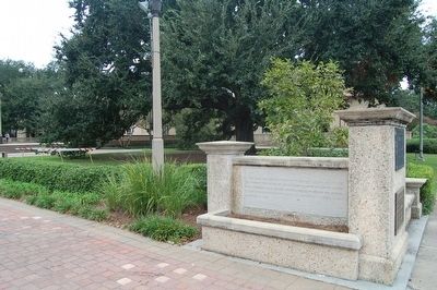
Louisiana State Seminary of Learning Foundation Stone
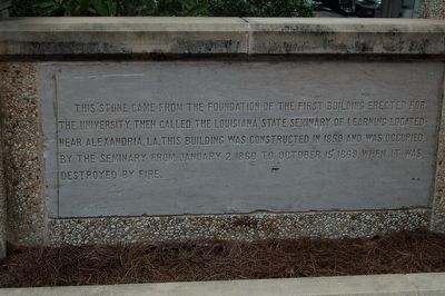
Inscription.
This stone came from the foundation of the first building erected for the university, then called the Louisiana State Seminary of Learning located near Alexandria, LA. This building was constructed in 1859 and was occupied by the seminary from January 2, 1860 to October 15, 1869, when it was destroyed by fire.
Topics. This historical marker is listed in this topic list: Education. A significant historical date for this entry is January 2, 1860.
Location. 30° 24.873′ N, 91° 10.704′ W. Marker is in Baton Rouge, Louisiana, in East Baton Rouge Parish. It is in Highlands/Perkins. Marker is on Tower Drive, 0.1 miles south of Dalrymple Drive, on the right when traveling south. Touch for map. Marker is in this post office area: Baton Rouge LA 70803, United States of America. Touch for directions.
Other nearby markers. At least 8 other markers are within walking distance of this marker. Land Grant College / Sea Grant College (here, next to this marker); Louisiana State University and Agricultural and Mechanical College (a few steps from this marker); Parade Ground (within shouting distance of this marker); The Louisiana State University (within shouting distance of this marker); Campanile (within shouting distance of this marker); a different marker also named Parade Ground (about 600 feet away, measured in a direct line); a different marker also named Parade Ground (about 600 feet away); a different marker also named Parade Ground (about 700 feet away). Touch for a list and map of all markers in Baton Rouge.
Credits. This page was last revised on February 12, 2023. It was originally submitted on November 27, 2015. This page has been viewed 302 times since then and 6 times this year. Photos: 1, 2. submitted on November 27, 2015. • Bernard Fisher was the editor who published this page.

