Near Saltville in Smyth County, Virginia — The American South (Mid-Atlantic)
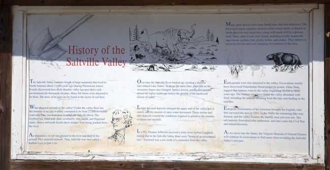
History of Saltville Valley
What attracted animals to the valley? Under the valley floor lies the remains of an old riverbed, estimated to be from 27,000 to 14.006 years old. This vanished river is called the Saltville River. The riverbed was lined with shale covered by slits, sands, and fingernail clams. Bones and tooth fossils show scrapes from being washed down the river. -
An abundance of salt was present in the river and deep in the ground, this attracted animals. Thus, Saltville was once called Buffalo Lick or Salt Lick.
Over time the Saltville River backed up, creating a shallow lake named Lake Totten. At about the same time, plant life on the mountain slopes also changed. Spruce forests, ponds, and prairies dotted the valley landscape before the growth of the hardwood forests of today.
In time the mud deposits changed the upper end of the valley into a marsh and the amount of open water decreased. These stream and lake deposits created the conditions required to preserve the remains of plants and animals.
In 1782, Thomas Jefferson received a letter from Arthur Campbell stating that in the Saltville Valley there were “bones of an uncommon size.” Enclosed was a jaw tooth of a mastodon from the valley.
Many other species have been found since this first discovery. The third most nearly complete skeleton of an extinct musk ox known in North America was found here, along with tracks left by a ground sloth. Many other fossils were found, including woolly mammoth stag-moose, caribou, fish, plants, turtles, and snakes. They inform us about the diverse and ever-changing environment in this area.
Early people were also attracted to the valley. Excavations nearby have discovered PaleoIndian fluted projectile points. Other finds suggest that humans were in the valley beginning 10,500 to 9000 years ago. The Indians must have found the valley abundant with food, including the animals drinking from the lake and feeding in the marshes.
European colonization of the Americas brought the English, who first surveyed the area in 1753. In the 1840s the remaining lake was drained, and the valley became the marshy area you now see. The salt industry flourished after settlement, and later came the Civil War and industrialization.
As we move into the future, the Virginia Museum of Natural History will continue its exavations to find more clues revealing the Saltville Valley’s rich past.
Erected by Virginia Museum of Natural History.
Topics. This historical marker is listed in these topic lists: Environment • Natural Resources • Notable Places. A significant historical year for this entry is 1753.
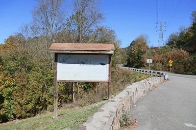
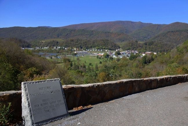
Location. 36° 52.243′ N, 81° 45.371′ W. Marker is near Saltville, Virginia, in Smyth County. Marker is at the intersection of Virginia Route 107 and the Saltville Overlook, on the left when traveling north on State Route 107. Touch for map. Marker is in this post office area: Saltville VA 24370, United States of America. Touch for directions.
Other nearby markers. At least 8 other markers are within 7 miles of this marker, measured as the crow flies. Saltville (approx. 0.8 miles away); U.S. General Stoneman's Raid (approx. 1.2 miles away); Saltville Defenses (approx. 1.2 miles away); Battle at Cedar Branch (approx. 1.3 miles away); Sulphur Springs Church and Campground (approx. 5.7 miles away); Fort Kilmachronan (approx. 6.1 miles away); Chilhowie Methodist Episcopal Church (approx. 6.3 miles away); Chilhowie (approx. 6.4 miles away). Touch for a list and map of all markers in Saltville.
Credits. This page was last revised on June 16, 2016. It was originally submitted on November 30, 2015, by J. J. Prats of Powell, Ohio. This page has been viewed 744 times since then and 78 times this year. Photos: 1, 2, 3. submitted on November 30, 2015, by J. J. Prats of Powell, Ohio.


