Near Cody in Park County, Wyoming — The American West (Mountains)
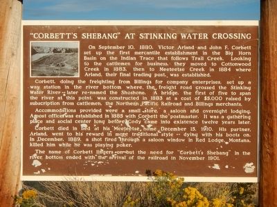
"Corbett's Shebang" at Sinking Water Crossing
Photographed by Barry Swackhamer, September 14, 2015
1. "Corbett's Shebang" at Sinking Water Crossing Marker
Corbett, doing the freighting from Billings for company enterprises, set up a way station in the river bottom where the freight road crossed the Stinking Water River—later renamed the Shoshone. A bridge, the first of five to span the river at this point, was constructed in 1883 at a cost of $5,000 raised by subscription from cattlemen, the Northern Pacific Railroad and Billings merchants.
Accommodations provided were a small store, a saloon and overnight lodging. The post office was established in 1885 with Corbett the postmaster. It was a gathering place and social center long before Cody came into existence twelve years later.
Corbett died in bed at his Meeteetse home December 15, 1910. His partner, Arland, went to his reward in more traditional style—dying with his
this page online
The name of Corbett lingers on but the need for “Corbett’s Shebang” in the river bottom ended with the arrival of the railroad in November 1901.
Erected by Wyoming State Parks & Cultural Resources.
Topics. This historical marker is listed in this topic list: Settlements & Settlers. A significant historical date for this entry is September 10, 1880.
Location. 44° 34.859′ N, 108° 58.223′ W. Marker is near Cody, Wyoming, in Park County. It is on Powell Highway (Alternate U.S. 14) near Happy Trails Road, on the left when traveling north. Touch for map. Marker is at or near this postal address: 4757 Powell Highway, Cody WY 82414, United States of America. Touch for directions.

Regionally, this marker is in the Bighorn Basin and in Greater Yellowstone. It is also in the American Mountain West and in the Lewis & Clark Corridor. Globally, it is in North America, the Rocky Mountains, the Western Hemisphere, the Western World, and the Anglosphere.
Other nearby markers. At least 8 other markers are within
Photographed by Barry Swackhamer, September 14, 2015
2. "Corbett's Shebang" at Sinking Water Crossing Marker
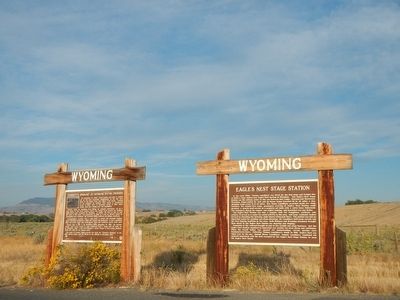
The marker is on the left.
Credits. This page was last revised on December 6, 2020. It was originally submitted on November 30, 2015, by Barry Swackhamer of Brentwood, California. This page has been viewed 1,388 times since then and 109 times this year. Photos: 1, 2. submitted on November 30, 2015, by Barry Swackhamer of Brentwood, California.
