Liverpool in Salina in Onondaga County, New York — The American Northeast (Mid-Atlantic)
Jesuit Mission
French Fort, Jesuit Well, Col. Van Schaick
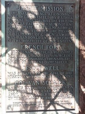
Jesuit Mission
The salt springs at Onondaga Lake were visited by Father LeMoyne, August 16, 1654. The following year Fathers Chaumonot and Dablon made a settlement here and on 1656 founded the mission of Ste. Marie of Ganentaa which was abandoned in 1658 because of the hostility of the Indians.
French Fort
Frontenac erected a palisaded enclosure August 3, 1696, before attacking Onondaga, then situated south of present Jamesville.
Jesuit Well
was situated on the site of the mission and fort near this point.
Col. Van Schaick
and his expedition encamped on the shore of the lake near here, April 21, 1779, after their attack on the villages of the Onondagas.
Erected 1930 by Syracuse Chapter, Sons of the American Revolution, and New York State.
Topics and series. This historical marker is listed in these topic lists: Churches & Religion • Forts and Castles • Wars, US Indian. In addition, it is included in the Sons of the American Revolution (SAR) series list. A significant historical date for this entry is August 16, 1654.
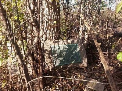
Location. 43° 5.571′ N, 76° 11.743′ W. Marker is in Salina, New York, in Onondaga County. It is in Liverpool. Marker is on Onondaga Lake Parkway (New York State Route 370 ) one mile south of Oswego Street. Marker is tipped on its side in overgrowth on a path behind the mission at the Skä•noñh - Great Law of Peace Center. Touch for map. Marker is at or near this postal address: 6680 Onondaga Lake Pkwy, Liverpool NY 13088, United States of America. Touch for directions.
Other nearby markers. At least 8 other markers are within 2 miles of this marker, measured as the crow flies. A Changing History (approx. ¾ mile away); Salt Potatoes (approx. ¾ mile away); The Salt Museum's Chimney (approx. ¾ mile away); Founded 1820 (approx. 0.9 miles away); Lucius Gleason House (approx. one mile away); Liverpool Lamp Post (approx. one mile away); Crucible Industries (approx. 1.8 miles away); The Great New York State Fair (approx. 1.9 miles away). Touch for a list and map of all markers in Salina.
More about this marker. GPS coordinates are for the path behind the mission; specific location alongside the path not defined.
Also see . . .
1. Skä•noñh - Great Law of Peace Center. Marker is on the grounds of the Skä•noñh - Great Law of Peace Center. (Submitted on December 1, 2015, by Anton Schwarzmueller of Wilson, New York.)
2. Goose Van Schaick - Wikipedia. (Submitted on December 1, 2015, by Anton Schwarzmueller of Wilson, New York.)
Credits. This page was last revised on February 16, 2023. It was originally submitted on December 1, 2015, by Anton Schwarzmueller of Wilson, New York. This page has been viewed 682 times since then and 47 times this year. Photos: 1, 2, 3. submitted on December 1, 2015, by Anton Schwarzmueller of Wilson, New York.


