Mount Pleasant Township near Gettysburg in Adams County, Pennsylvania — The American Northeast (Mid-Atlantic)
Second Division
Cavalry Corps
— Army of the Potomac —
Cavalry Corps
Second Division
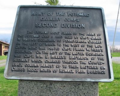
The extreme right flank of the Army of the Potomac July 3, 1863. Held by Capt. James W. Walsh's Squadron 3d Pennsylvania Cavalry on the left of which to the west of the Low Dutch Road was posted Capt. Frank W. Hess's Squadron. On the left of the latter squadron was Capt. Wm. E. Miller's Battalion of the Regiment which charged through the Confederate column almost up to their batteries on Cress's Ridge north of Rummel Farm Buildings.
Erected 1913 by Gettysburg National Military Park Commission.
Topics. This historical marker is listed in this topic list: War, US Civil. A significant historical date for this entry is July 3, 1863.
Location. 39° 49.712′ N, 77° 9.484′ W. Marker is near Gettysburg, Pennsylvania, in Adams County. It is in Mount Pleasant Township. Marker is on Low Dutch Road, on the right when traveling north. Located in Gettysburg National Military Park. Touch for map. Marker is in this post office area: Gettysburg PA 17325, United States of America. Touch for directions.
Other nearby markers. At least 10 other markers are within walking distance of this marker. Third Pennsylvania Cavalry (approx. ¼ mile away); Gregg Cavalry Shaft (approx. 0.3 miles away); First Brigade (approx. 0.3 miles away); a different marker also named Second Division (approx. 0.3 miles away); 1st Regiment Maryland Cavalry (approx. 0.4 miles away); Co. A Purnell Legion (approx. 0.4 miles away); Come on You Wolverines (approx. 0.4 miles away); Second Brigade (approx. 0.4 miles away); Michigan Cavalry Brigade (approx. 0.4 miles away); The Brook Rawle Memorial Flagpole (approx. half a mile away). Touch for a list and map of all markers in Gettysburg.
Also see . . . James William Walsh - Find-a-grave. Enlisted as a private in 1850 and rose rapidly in rank during the Civil War . He is recorded as being in Bristoe's Campaign under General Alfred Pleaseonton where he was a regimental commander in the 2nd Division, 1st Brigade, 3rd Pennsylvania Cavalry. He was acquainted with BGen George Armstrong Custer as he was the 3rd Division, 2nd Brigade's commander at this time. (Submitted on November 29, 2015, by Brian Scott of Anderson, South Carolina.)
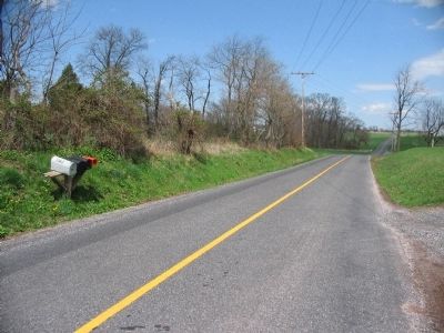
Photographed By Craig Swain, April 12, 2008
5. Low Dutch Road
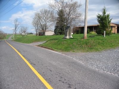
Looking to the north from the marker location. Low Dutch Road was the far right flank of the Union army on day 3 of the Battle of Gettysburg. The 3rd Pennsylvania Cavalry anchored this position, deployed mostly to the west (left of photo) of the road.
Credits. This page was last revised on February 7, 2023. It was originally submitted on July 13, 2008, by Craig Swain of Leesburg, Virginia. This page has been viewed 1,142 times since then and 11 times this year. Photos: 1. submitted on July 13, 2008, by Craig Swain of Leesburg, Virginia. 2. submitted on November 29, 2015, by Brian Scott of Anderson, South Carolina. 3. submitted on July 13, 2008, by Craig Swain of Leesburg, Virginia. 4. submitted on November 29, 2015, by Brian Scott of Anderson, South Carolina. 5. submitted on July 13, 2008, by Craig Swain of Leesburg, Virginia.
