Near Lovell in Big Horn County, Wyoming — The American West (Mountains)
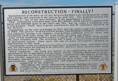
Reconstruction - Finally!
Then, construction costs were more than $2.4 million, which was very expensive compared with $33,000 spent in the 1920s and '30s, but by today's standards was a real bargain. There were 11 prime contractors and 18 contracts involved in the process.
Construction on the east end began in 1967 and the entire road was completed in 1983. The process involved serval unique road-building techniques. Surveyors and engineers became rock climbers, rock-bolting techniques stabilized vertical walls and reinforced earth walls made the road stable on steep side slopes.
Each of five reinforced walls is a mass of earth fill, in which metal strips anchor the outer retaining wall. The retaining wall is made of interlocking metal panels in horizontal layers. They were but one of many innovations utilized in construction of this road.
Construction crews rock-bolted vertical faces to stabilize them, and where rock was too fractured for bolting to be effective, surfaces were secured with metal netting bolted to the rock.
When completed, the road was hailed as an engineering and construction masterpiece for its placement in steep alpine terrain. Literally hundreds of people are responsible for its design, engineering, construction and support programs. Most notable supporters were Governors Cliff Hansen, Stan Hathaway, Ed Herscher and many workers employed during their terms. In addition local personalities, supporters, contractors and suppliers played a vital role in completion of the highway.
Throughout the entire construction process, funding was and continues to be, a significant factor. In varying quantities, funds to build this 52 miles of road were provided from federal, state and local sources.
Erected by Wyoming Transportation Department, Mary Alice Fortin Foundation of Florida and Big Horn Mountain Medicine Wheel Association.
Topics. This historical marker is listed in this topic list: Roads & Vehicles.
Location. 44° 47.37′ N, 107° 58.218′ W. Marker is near Lovell, Wyoming, in Big Horn County. Marker is on Alternate U.S. 14A at milepost 71 near Old U.S. Highway 14A, on the left when traveling east. Touch for map. Marker is in this post office area: Lovell WY 82431, United States of America. Touch for directions.
Other nearby markers. At least 8 other markers are within 7 miles of this marker, measured as the crow flies. The Original Dayton-Kane Highway (approx. one mile away); Big Horn Basin (approx. 1.9 miles away); Bighorn Basin (approx. 1.9 miles away); Welcome to the Medicine Wheel (approx. 3˝ miles away); Five Springs (approx. 3.6 miles away); Medicine Wheel (approx. 4.1 miles away); a different marker also named Medicine Wheel (approx. 4.1 miles away); a different marker also named Medicine Wheel (approx. 6˝ miles away). Touch for a list and map of all markers in Lovell.
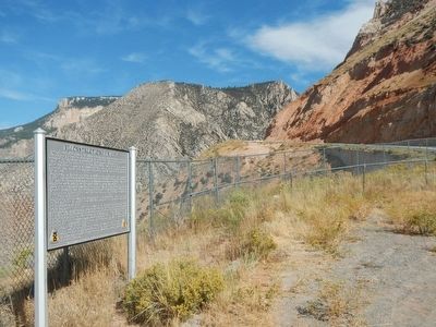
More about this marker. This marker is located at an turnout on U.S. Highway 14A about halfway between intersections with Old U.S. Highway 14A and Forest Service Road 651.
Credits. This page was last revised on June 16, 2016. It was originally submitted on December 5, 2015, by Barry Swackhamer of Brentwood, California. This page has been viewed 402 times since then and 14 times this year. Photos: 1, 2. submitted on December 5, 2015, by Barry Swackhamer of Brentwood, California.

