Tyler in Smith County, Texas — The American South (West South Central)
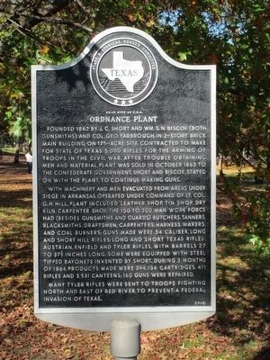
Ordnance Plant
Near Site of C.S.A.
With machinery and men evacuated from areas under siege in Arkansas, operated under the command of Lt. Col. G.H. Hill. Plant included leather shop, tin shop, dry kiln, carpenter shop. The 150 to 200 man work force had (besides gunsmiths and guards) butchers, tanners, blacksmiths, draftsmen, carpenters, harness makers, and coal burners; guns made were .54 caliber, long and short Hill Rifles; long and short Texas Rifles; Austrian, Enfield and Tyler Rifles, with barrels 27 to 37½ inches long. Some were equipped with steel tipped bayonets invented by Short. During 3 months of 1864, products made were 394,156 cartridges, 411 rifles and 3,531 canteens; 160 guns were repaired.
Many Tyler rifles were sent to troops fighting north and east of Red River, to prevent a Federal invasion of Texas.
Erected 1968 by State Historical Survey Committee. (Marker Number 7763.)
Topics. This historical marker is listed in this topic list: War, US Civil. A significant historical year for this entry is 1862.
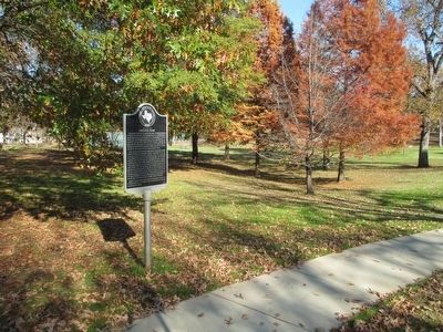
Location. 32° 19.927′ N, 95° 18.139′ W. Marker is in Tyler, Texas, in Smith County. Marker is at the intersection of West Fourth Street (State Highway 64/110) and South College Avenue, on the right when traveling west on West Fourth Street. This marker is near the southwest corner of Bergfeld Park. Touch for map. Marker is in this post office area: Tyler TX 75701, United States of America. Touch for directions.
Other nearby markers. At least 8 other markers are within walking distance of this marker. Rudolph Bergfeld (about 600 feet away, measured in a direct line); Site of Confederate Arms Factory (approx. 0.4 miles away); Woman's Building (approx. half a mile away); Gary Elementary School (approx. 0.7 miles away); Chilton-Lipstate-Taylor House (approx. 0.7 miles away); The Connally Home (approx. 0.7 miles away); Ramey House (approx. 0.8 miles away); Whitaker-McClendon House (approx. 0.9 miles away). Touch for a list and map of all markers in Tyler.
Regarding Ordnance Plant. This marker is approximately one third mile from the actual location of the Ordnance Works. When the Confederate Ordnance Bureau purchased the private company facilities, all of the men and some of the equipment from the Little Rock, Arkansas Arsenal was moved to this facility in October 1863. At its peak in early 1865 the facility employed nearly 400 men. It was abandoned in early May 1865.
Credits. This page was last revised on July 19, 2016. It was originally submitted on December 6, 2015, by Randal B. Gilbert of Tyler, Texas. This page has been viewed 768 times since then and 86 times this year. Photos: 1, 2. submitted on December 6, 2015, by Randal B. Gilbert of Tyler, Texas. • Bernard Fisher was the editor who published this page.

