Jacksonville in Telfair County, Georgia — The American South (South Atlantic)
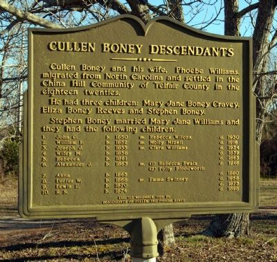
Cullen Boney Descendants
Photographed by David Seibert, January 27, 2008
1. Cullen Boney Descendants Marker
He had three children: Mary Jane Boney Cravey, Eliza Boney Reeves and Stephen Boney.
Stephen Boney married Mary Jane Williams and they had the following children:
1. John C. b. 1850 m. Rebecca Wilcox d. 1930
2. William F. b. 1852 m. Molly Mizell d. 1916
3. Joseph J. b. 1853 m. Clara Williams d. 1934
4. Wiley M. b. 1858 d. 1859
5. Rebecca b. 1861, d. 1863
6. Alexander J. b. 1863 m. (1) Rebecca Swain d. 1946
(2) Polly Bloodworth
7. Anna, b. 1865, d. 1880
8. Lucius W. b. 1868 m. Emma Swinney d. 1958
9. Lewis E. b. 1870 d. 1873
10. R.S. b. 1874, d. 1898
Erected 1994 by Descendants of Cullen and Phoebe Boney.
Topics. This historical marker is listed in this topic list: Settlements & Settlers. A significant historical year for this entry is 1850.
Location. 31° 51.159′ N, 83° 5.087′ W. Marker is in Jacksonville, Georgia, in Telfair County. It is on Georgia Route 117 at milepost 27, 7 miles west of U.S. 319/441,
this page online

Regionally, this marker is on the Coastal Plain. It is also in the American South and specifically in the Deep South. Globally, it is in North America, the Western Hemisphere, the Western World, and the Anglosphere. Historically, it finds itself in what was once the territory of the Mississippian Culture, one of the original Thirteen Colonies, one of the Confederate States of America, and the Antebellum South.
Other nearby markers. At least 8 other markers are within 14 miles of this marker, measured as the crow flies: Old Courthouse Location (approx. 6.8 miles away); Jacksonville (approx. 6.8 miles away); Ozias Church Bethlehem Church (approx. 10.4 miles away); Battle of Breakfast Branch (approx. 12.6 miles away); In Grateful Appreciation of The Boys of Ben Hill Co. (approx. 13.6 miles away); Ben Hill County (approx. 13.6 miles away); Portable Confinement Cage (approx. 13.7 miles away); Jefferson Davis Memorial State Park
Photographed by David Seibert, June 30, 2012
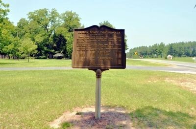
2. Cullen Boney Descendants Marker
Looking west on Georgia Highway 117
Another marker is no longer nearby. Old Coffee Road (was approx. 8.2 miles away but has been confirmed missing).
Credits. This page was last revised on February 1, 2020. It was originally submitted on July 13, 2008, by David Seibert of Sandy Springs, Georgia. This page has been viewed 2,033 times since then and 60 times this year. Photos: 1. submitted on July 13, 2008, by David Seibert of Sandy Springs, Georgia. 2. submitted on July 4, 2012, by David Seibert of Sandy Springs, Georgia. • Kevin W. was the editor who published this page.
