Near Buffalo in Johnson County, Wyoming — The American West (Mountains)
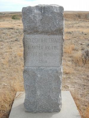
Bozeman's Trail:
A Versatile Travel Corridor
Inscription.
Travel along the Bozeman Trail began in 1863 as miners carrying their supplies on packhorses or in wagons, headed toward the gold fields. Compared to other available methods and road of travel, this route was a shortcut to Virginia City. Storekeepers and freighters followed the miners. hauling sale goods in huge double-freight wagons towed by 20 oxen. The first cattle herd followed the trail in 1866, when Nelson Story's herders drove a thousand animals from Texas to Virginia City. By 1867, civilian traffic on the trail had fallen off. Indian opposition was having an effect, and travel was limited to mail patrols and military supplies. The trail was closed as a result of the Fort Laramie Treaty of 1868, only to reopen for military use during the 1876 campaigns.
Topics. This historical marker is listed in this topic list: Roads & Vehicles.
Location. 44° 5.04′ N, 106° 31.452′ W. Marker is near Buffalo, Wyoming, in Johnson County. Marker can be reached from Buffalo Sussex Cutoff Road near Irigaray Road, on the right when traveling north. Touch for map. Marker is in this post office area: Buffalo WY 82834, United States of America. Touch for directions.
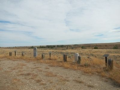
Other nearby markers. At least 5 other markers are within 14 miles of this marker, measured as the crow flies. Lieut. N.P. Daniels, U.S.A. (here, next to this marker); Conflict at the Crossing (here, next to this marker); The Legend of Crazy Woman (a few steps from this marker); TA Ranch (approx. 10.1 miles away); Tisdale Divide (approx. 13.9 miles away).
More about this marker. This marker is found at the Crazy Woman Battlefield Monument. From U.S. Highway 87, take Exit 291, Buffalo Sussex Cutoff Road (Trabing Road) to the southeast for 12 to 15 miles. When you reach the Irigaray Road junction, make a U-turn and head north about 1 mile. There, take the poorly signed ranch road to the right about 1/4 mile. The marker(s) will be at a pullout on the right.
Credits. This page was last revised on June 16, 2016. It was originally submitted on December 13, 2015, by Barry Swackhamer of Brentwood, California. This page has been viewed 524 times since then and 25 times this year. Photos: 1, 2, 3. submitted on December 13, 2015, by Barry Swackhamer of Brentwood, California.


