Danville in Contra Costa County, California — The American West (Pacific Coastal)
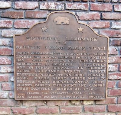
Captain Pedro Fages Trail
Historical Landmark 1772
Fages, Commandante at Monterey, vainly looked for a way across San Francisco Bay. With Juan Crespi, Franciscan missionary, 14 soldiers, a muleteer and an Indian servant, he trekked along Carquinez Strait, thence eastward nearly to Antioch. Turning back, these first white men to explore what became Contra Costa County, passed this point and camped near Danville March 31, 1772.
Placed and dedicated April 1, 1972
San Ramon Valley Historical Society
Erected 1972 by San Ramon Valley Historical Society. (Marker Number 853.)
Topics and series. This historical marker is listed in this topic list: Exploration. In addition, it is included in the California Historical Landmarks series list. A significant historical date for this entry is March 31, 1772.
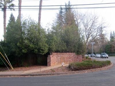
Location. 37° 50.063′ N, 122° 0.982′ W. Marker is in Danville, California, in Contra Costa County. Marker is at the intersection of Danville Boulevard and El Portal on Danville Boulevard. Touch for map. Marker is in this post office area: Danville CA 94526, United States of America. Touch for directions.
Other nearby markers. At least 8 other markers are within 2 miles of this marker, measured as the crow flies. Alamo Cemetery (about 600 feet away, measured in a direct line); Hap Magee Ranch (approx. 0.3 miles away); The Tatcan People (approx. half a mile away); The Railroad Put Alamo on the Map (approx. 0.7 miles away); San Ramon Union High School (approx. 0.9 miles away); Love House (approx. 0.9 miles away); James Root House (approx. 1.1 miles away); Austin Root House, 1919 (approx. 1.1 miles away). Touch for a list and map of all markers in Danville.
More about this marker. This marker is California State Historical Landmark Number 853.
Also see . . . Pedro Fages. Wikipedia entry (Submitted on March 3, 2024, by Larry Gertner of New York, New York.)
Credits. This page was last revised on March 3, 2024. It was originally submitted on December 19, 2015, by Andrew Ruppenstein of Lamorinda, California. This page has been viewed 541 times since then and 25 times this year. Photos: 1, 2. submitted on December 19, 2015, by Andrew Ruppenstein of Lamorinda, California.

