
Jacksonville in Jackson County, Oregon — The American West (Northwest)
Catholic Rectory
Photographed by Andrew Ruppenstein, June 22, 2014
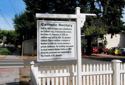
1. Catholic Rectory Marker
Built in 1866 as a one room schoolhouse for Catholic boys, it became the rectory for Father F.X. Blanchet in 1870. An addition was built in 1891. St. Joseph's Catholic Church became a mission of Medford in 1908 the rectory became a private residence. The building was saved by local resident Robbie Collins in 1967. Presently preserved and maintained by The Friends of St. Josephs (sic).
Topics. This historical marker is listed in these topic lists: Education • Religion & Religious Structures. A significant historical year for this entry is 1866.
Location. 42° 18.879′ N, 122° 57.977′ W. Marker is in Jacksonville, Oregon, in Jackson County. It is at the intersection of North 4th Street and East C Street, on the left when traveling south on North 4th Street. Touch for map. Marker is at or near this postal address: 204 North 4th Street, Jacksonville OR 97530, United States of America. Touch for directions.

Regionally, this marker is in Southern Oregon. It is also on the American Pacific Coast, in the Pacific Northwest, and in the Lewis & Clark Corridor. Globally, it is in North America, in the Cascade Range, on the
this page online
Other nearby markers. At least 8 other markers are within walking distance of this marker: Methodist Episcopal Church (about 300 feet away, measured in a direct line); Beekman Bank Well (about 400 feet away); Warren Lodge No. 10 (about 400 feet away); P.J. Ryan’s Dwelling House (about 500 feet away); History Right Here - Horse Powers (about 500 feet away); Rogue River Valley Railroad Depot (about 600 feet away); History of Local Telephone Service (about 600 feet away); City Hall (about 800 feet away). Touch for a list and map of all markers in Jacksonville.
Also see . . . St. Joseph’s Catholic Rectory. HistoricJacksonville.org presents a very short history of the rectory. (Submitted on December 22, 2015.)
Photographed by Andrew Ruppenstein, June 22, 2014
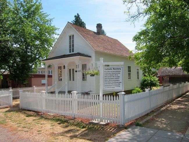
2. St. Joseph's Catholic Rectory and Marker
The buildings and grounds were purchased and restored in 1967 by the St. Joseph’s Rectory Acquisition Committee. In 1968, they were turned over to the Southern Oregon Historical Society to manage. In 2002, this historical landmark was conveyed to Jackson County although the property continued under SOHS management. In 2010, management was transferred to the Jacksonville Heritage Society. - Jacksonville Heritage Society
Credits. This page was last revised on October 14, 2024. It was originally submitted on December 22, 2015, by Andrew Ruppenstein of Lamorinda, California. This page has been viewed 666 times since then and 50 times this year. Photos: 1, 2. submitted on December 22, 2015, by Andrew Ruppenstein of Lamorinda, California.
