El Cerrito in Contra Costa County, California — The American West (Pacific Coastal)
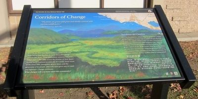
Corridors of Change
Senderos del Cambio
⎯⎯⎯
变化的走廊
Photographed by Andrew Ruppenstein, November 21, 2015
1. Corridors of Change Marker

The fields are green with grass and thickly covered with various wildflowers." - Juan Bautista de Anza
In 1776, the non-Native settlers arrived in the Bay Area, led by Juan Bautista de Anza. Dramatic change arrived with them. The multiethnic colonists followed Indian trails 1,800 miles across the frontier of New Spain. A small party explored present-day El Cerrito. Anza wrote of the area's hills, mosquitos, grizzly bears, and the generosity of its people. Old tails have given way to roads and highways. Change continues.
What changes will you leave upon this community?
this page online
Erected 2015
Photographed by Andrew Ruppenstein, November 21, 2015
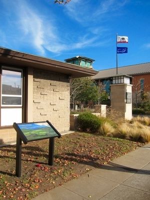
2. Corridors of Change Marker - Wide View
Topics and series. This historical marker is listed in this topic list: Exploration. In addition, it is included in the Juan Bautista de Anza National Historic Trail series list. A significant historical date for this entry is April 1, 1776.
Location. 37° 54.955′ N, 122° 18.692′ W. Marker is in El Cerrito, California, in Contra Costa County. It is at the intersection of San Pablo Avenue and Manila Avenue, on the right when traveling north on San Pablo Avenue. Touch for map. Marker is in this post office area: El Cerrito CA 94530, United States of America. Touch for directions.

Regionally, this marker is in the San Francisco Bay Area and on the Coast Ranges. It is also on the American Pacific Coast. Globally, it is in North America, on the Ring of Fire, on the Pacific Rim, in the Western Hemisphere, in the Western World, and in the Anglosphere. Historically, it finds itself in what was once New Spain and also Mexico’s Alta California.
Other nearby markers. At least 8 other markers are within walking distance of this marker: City Hall (here, next to this marker); Forced Removal
Photographed by Andrew Ruppenstein, November 21, 2015
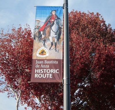
3. Juan Bautista de Anza Banner - One of Six Installed in El Cerrito
More about this marker. The marker is located out in front of the El Cerrito Fire/Police Department Offices.
Also see . . .
1. DeSaulner hosting town-hall meeting; banners to be dedicated at ceremony. El Cerrito is the first city to install commemorative banners that highlight the historic Anza Expedition that came through the area almost 240 years ago. A ceremony at 3 p.m. Aug. 25 at City Hall Plaza, San Pablo and Manila avenues, will dedicate the banners and a historical marker commemorating the 1,800-mile expedition that brought the first European settlers to California, as well as the fact that Anza passed through the area that is now modern-day El Cerrito on April 1, 1776....The marker is being installed in front of the city's public safety building across the street from City Hall....The banners and marker and a collaboration between the El Cerrito Historical Society and the National Park Service, which oversees the 1,200-mile Juan Bautista de Anza National Historic Trail. (Submitted on December 27, 2015.)
2. Juan Bautista de Anza National Historic Trail - National Park Service. (Submitted on December 27, 2015.)
Credits. This page was last revised on July 20, 2020. It was originally submitted on December 27, 2015, by Andrew Ruppenstein of Lamorinda, California. This page has been viewed 587 times since then and 20 times this year. Photos: 1, 2, 3. submitted on December 27, 2015, by Andrew Ruppenstein of Lamorinda, California.
