Near Winton in Merced County, California — The American West (Pacific Coastal)
The Montpelier-Oakdale Railroad
1890 to 1942
Photographed by Andrew Ruppenstein, May 18, 2014
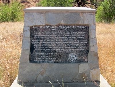
1. The Montpelier-Oakdale Railroad Marker
This important Southern Pacific Route was called by many names, also including, "The Stockton-Tulare Railroad", "The Oakdale Line", "The Oakdale-Montpelier Railroad", and "The Eastside Route". There were North and South bound trains daily. Passengers, wheat, cattle, equipment, and new settlers were its daily cargo.
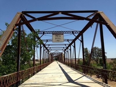
From the North the train would depart Stockton. Stopping at Peters, Oakdale, Waterford, Hickman, Montpelier, Ryre, Basel (Merced River), Arundel, Amsterdam, Nairn, Ferrin, and into Merced. From Merced the reverse would be true. Merced residents would ride the train into Basel to enjoy the recreation of the Merced River. The "Shaffer Bridge" was built in 1912, twenty two years after the train's trestle was erected. The route was discontinued because of the demands of World War II.
Clamper Year 6000
Russ Potts
Noble Grand Humbug
Estanislao Chapter No. 58
E Clampus Vitus
Erected 1995 by E Clampus Vitus Estanislao Chapter No. 58.
Topics and series. This historical marker is listed in these topic lists: Bridges & Viaducts • Railroads & Streetcars. In addition, it
this page online
Location. 37° 27.567′ N, 120° 36.829′ W. Marker is near Winton, California, in Merced County. It is on Oakdale Road south of Turlock Road, on the right when traveling south. Touch for map. Marker is at or near this postal address: 7150 Oakdale Road, Winton CA 95388, United States of America. Touch for directions.

Regionally, this marker is in the San Joaquin Valley and specifically in the Central Valley. It is also on the American Pacific Coast. Globally, it is in North America, on the Ring of Fire, on the Pacific Rim, in the Western Hemisphere, in the Western World, and in the Anglosphere. Historically, it finds itself in what was once New Spain and also Mexico’s Alta California.
Other nearby markers. At least 8 other markers are within 13 miles of this marker, measured as the crow flies: Castle Air Force Base (approx. 6.9 miles away); A Comrade’s Tribute to Brig. Gen. Frederick W. Castle A.A.F. (approx. 6.9 miles away); Castle Memorial Parade Ground (approx. 6.9 miles away); First Court House in Merced County (approx. 10½ miles
Photographed by Andrew Ruppenstein, May 18, 2014
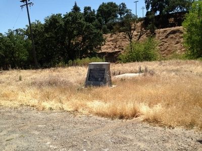
2. The Montpelier-Oakdale Railroad Marker - Wide View
Photographed by Andrew Ruppenstein, May 18, 2014
3. The Schaffer Bridge (1912)
Credits. This page was last revised on June 16, 2016. It was originally submitted on December 27, 2015, by Andrew Ruppenstein of Lamorinda, California. This page has been viewed 1,503 times since then and 84 times this year. Photos: 1, 2, 3. submitted on December 27, 2015, by Andrew Ruppenstein of Lamorinda, California.
