Mooresburg in Hawkins County, Tennessee — The American South (East South Central)
Williams Home Place
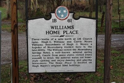
Photographed by Tom Bosse, December 25, 2015
1. Williams Home Place Marker
Erected by Tennesse Historical Commission. (Marker Number 1B 61.)
Topics and series. This historical marker is listed in this topic list: Settlements & Settlers. In addition, it is included in the Tennessee Historical Commission series list.
Location. 36° 20.731′ N, 83° 13.353′ W. Marker is in Mooresburg, Tennessee, in Hawkins County. It is on Church Street, on the right when traveling north. Touch for map. Marker is at or near this postal address: 132 Church Street, Mooresburg TN 37811, United States of America. Touch for directions.

Regionally, this marker is in East Tennessee and in the Tri-Cities
this page online
Other nearby markers. At least 8 other markers are within 7 miles of this marker, measured as the crow flies: Mulberry Grove (approx. ¼ mile away); Tidence Lane (approx. 6.2 miles away); Longstreet's Headquarters (approx. 6.3 miles away); Longstreet's Billet (approx. 6.3 miles away); Hayslope (approx. 6.4 miles away); Coffman House (approx. 6.4 miles away); Cheek's Crossroads (approx. 6.6 miles away); Donald J. Ross (approx. 6.7 miles away).
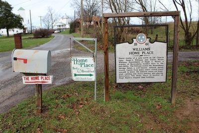
Photographed by Tom Bosse, December 25, 2015
2. Williams Home Place Marker
Credits. This page was last revised on June 16, 2016. It was originally submitted on December 29, 2015, by Tom Bosse of Jefferson City, Tennessee. This page has been viewed 808 times since then and 37 times this year. Photos: 1, 2. submitted on December 29, 2015, by Tom Bosse of Jefferson City, Tennessee. • Bill Pfingsten was the editor who published this page.
