Near Port Edward in North Coast, British Columbia — Canada’s West Coast (North America)
North Pacific Cannery
Photographed by Dawn Bowen, July 7, 2008
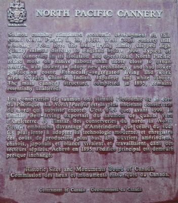
1. North Pacific Cannery Marker
Les conserveries de saumon ont stimulé l’économie de la côte du Pacifique. La North Pacific est la plus anciennne conserverie du nord qui subsiste encore. C’est d’ici que, avant 1900, la famille Bell-Irving exportait du saumon de qualité vers l’Angleterre. À l’instar des conserveries du nord, la North Pacific embaucha davantage d’Amérindiens que celles du sud, fut plus lente à adopter la technologie moderne, et enregistra des coûts de production plus bas. Les ouvriers amérindiens, chinois, japonais, et blancs vivaient et travaillaient
this page online
Erected 1983 by Historic Sites and Monuments Board of Canada.
Topics and series. This historical marker is listed in these topic lists: Natural Resources • Settlements & Settlers. In addition, it is included in the Canada, Historic Sites and Monuments Board series list. A significant historical year for this entry is 1900.
Location. 54° 11.682′ N, 130° 13.487′ W. Marker is near Port Edward, British Columbia, in North Coast. It is on Skeena Drive, on the right when traveling south. The marker is about 3.3 miles south of Port Edward. Touch for map. Marker is at or near this postal address: Skeena Drive, Port Edward BC V0V 1G0, Canada. Touch for directions.

Regionally, this marker is in Northern BC. Globally, it is in North America, on the Ring of Fire, on the Pacific Rim, in the Western Hemisphere, in the Western World, and in the Anglosphere. Historically, it finds itself in what was once a British colony.
Other nearby markers. At least 8 other markers are within 16 kilometers of this marker, measured as the crow flies:
Photographed by Dawn Bowen, July 7, 2008
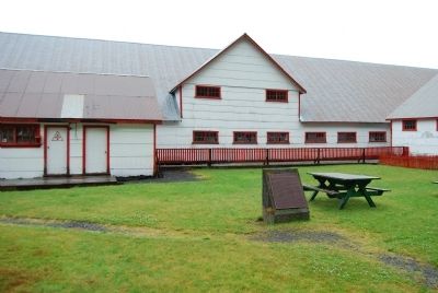
2. North Pacific Cannery Marker
Photographed by Dawn Bowen, July 7, 2008
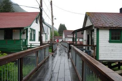
3. Boardwalk at North Pacific Cannery
Photographed by Dawn Bowen, July 7, 2008
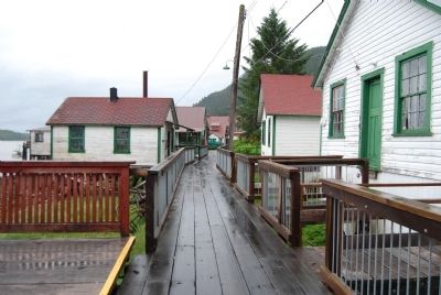
4. Boardwalk at North Pacific Cannery
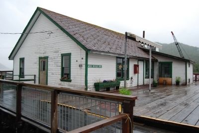
Photographed by Dawn Bowen, July 7, 2008
5. Mess Hall at North Pacific Cannery
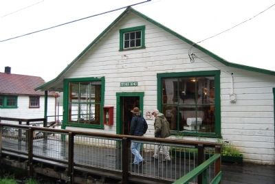
Photographed by Dawn Bowen, July 7, 2008
6. Store at North Pacific Cannery
Credits. This page was last revised on March 16, 2026. It was originally submitted on July 11, 2008, by Dawn Bowen of Fredericksburg, Virginia. This page has been viewed 2,160 times since then and 19 times this year. Last updated on July 16, 2008, by Dawn Bowen of Fredericksburg, Virginia. Photos: 1, 2, 3, 4, 5, 6. submitted on July 11, 2008, by Dawn Bowen of Fredericksburg, Virginia. • Kevin W. was the editor who published this page.
