Coolidge in Limestone County, Texas — The American South (West South Central)
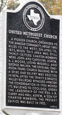
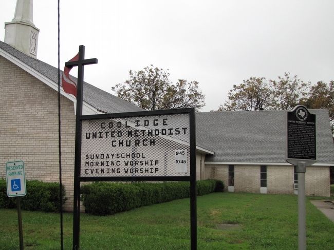
United Methodist Church of Coolidge
Inscription.
A pioneer church, organized in the Armour community, about two miles to the west, on April 10, 1873, when this area was still thinly-settled. Charter members were John and Caroline Askew, A. J. Moore, Leona Waddell, and George Walker. The original one room frame church building with a spire and belfry was erected in 1874. After the Trinity & Brazos Valley Railroad bypassed Armour, the congregation in 1904 moved its building to Coolidge. Under the leadership of the Rev. J. B. Curry and Hull Askew, a son of charter members, the present edifice was built in 1922.
Erected 1974 by Texas Historical Commission. (Marker Number 5601.)
Topics. This historical marker is listed in these topic lists: Churches & Religion • Settlements & Settlers. A significant historical date for this entry is April 10, 1873.
Location. 31° 45.242′ N, 96° 39.083′ W. Marker is in Coolidge, Texas, in Limestone County. Marker is at the intersection of Jester Street and North 3rd Street, on the left when traveling west on Jester Street. Touch for map. Marker is at or near this postal address: 306 Jester St, Coolidge TX 76635, United States of America. Touch for directions.
Other nearby markers. At least 8 other markers are within 11 miles of this marker, measured as the crow flies. Armour Cemetery (approx. 1.3 miles away); Munger Community (approx. 4˝ miles away); Tehuacana Cemetery (approx. 6.2 miles away); Tehuacana (approx. 6.3 miles away); William Rees (approx. 6.3 miles away); Booker T. Washington Park (approx. 7.4 miles away); Joseph E. Johnston Reunion Grounds (approx. 10 miles away); Evangelist Lester L. Roloff (approx. 10.4 miles away). Touch for a list and map of all markers in Coolidge.
Credits. This page was last revised on June 16, 2016. It was originally submitted on January 9, 2016, by QuesterMark of Fort Worth, Texas. This page has been viewed 402 times since then and 12 times this year. Photos: 1, 2. submitted on January 9, 2016, by QuesterMark of Fort Worth, Texas. • Bernard Fisher was the editor who published this page.

