Rüdesheim am Rhein in Rheingau-Taunus-Kreis, Hesse, Germany — Central Europe
Boosenburg Castle
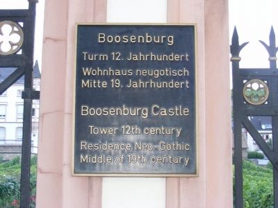
Photographed by Don Morfe, July 2, 2008
1. Bossenburg Castle Marker

Tower 12 Century, Residence Neo-Gothic Middle of 19th Century.
Topics. This historical marker is listed in this topic list: Forts and Castles.
Location. 49° 58.698′ N, 7° 55.074′ E. Marker is in Rüdesheim am Rhein, Hessen (Hesse), in Rheingau-Taunus-Kreis. It is on Oberstrasse. Touch for map. Marker is at or near this postal address: Rheinstraße 3, Rüdesheim am Rhein HE 65385, Germany. Touch for directions.

Regionally, this marker is on the German Upper Rhine and specifically in the Upper Middle Rhine Valley. Globally, it is in Europe, the European Union, Atlantic Europe, Central Europe, the Schengen Area, Western Europe, and the Western World. Historically, it finds itself in what was once the Roman Empire, the Holy Roman Empire, and the former West Germany.
Other nearby markers. At least 6 other markers are within 10 kilometers of this marker, measured as the crow flies: Adlerturm / Eagle Tower (approx. 0.6 kilometers away); Johann Schlaad (1822-1892) (approx. 8.2
this page online
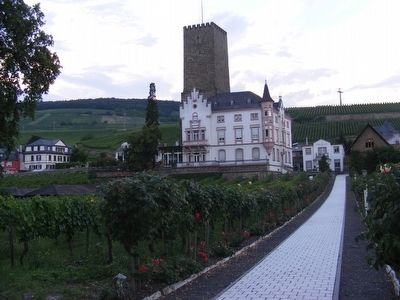
Photographed by Don Morfe, July 2, 2008
2. Bossenburg Castle Marker
Credits. This page was last revised on November 1, 2025. It was originally submitted on January 16, 2016, by Don Morfe of Baltimore, Maryland. This page has been viewed 593 times since then and 22 times this year. Photos: 1, 2. submitted on January 16, 2016, by Don Morfe of Baltimore, Maryland. • Bill Pfingsten was the editor who published this page.
