Fort Eustis in Newport News, Virginia — The American South (Mid-Atlantic)
Glebe Lands
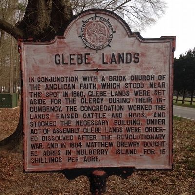
Photographed by Kevin W., January 7, 2016
1. Glebe Lands Marker
Erected by Corporation of Newport News, Virginia.
Topics and series. This historical marker is listed in this topic list: Religion & Religious Structures. In addition, it is included in the Virginia, Corporation of Newport News series list. A significant historical year for this entry is 1660.
Location. 37° 9.794′ N, 76° 34.748′ W. Marker is in Newport News, Virginia. It is in Fort Eustis. It is on Monroe Avenue just north of Dillon Circle, on the right when traveling south. Touch for map. Marker is in this post office area: Fort Eustis VA 23604, United States of America. Touch for directions.

Regionally, this marker is on Virginia’s Peninsula, in Hampton Roads, in Coastal Virginia, and in
this page online
Other nearby markers. At least 8 other markers are within walking distance of this marker: YAC-1 / CV-2 / CV-7 Caribou (about 800 feet away, measured in a direct line); CH-54 Tarhe (about 800 feet away); U-1A Otter (about 800 feet away); Airgeep II VZ-8P (B) (approx. 0.2 miles away); CH-37 Mojave (approx. 0.2 miles away); U-6A Beaver (approx. 0.2 miles away); GEM, Model 2500 Air Car (approx. 0.2 miles away); H-25A Mule (approx. 0.2 miles away). Touch for a list and map of all markers in Newport News.
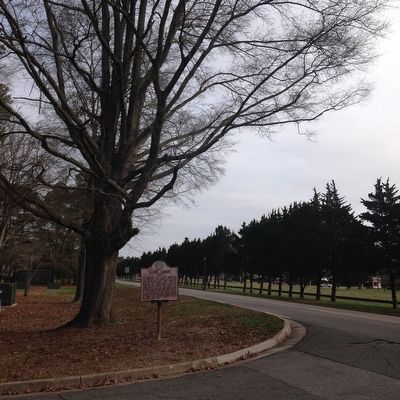
Photographed by Kevin W., January 7, 2016
2. Glebe Lands Marker
Credits. This page was last revised on February 1, 2023. It was originally submitted on January 23, 2016, by Kevin W. of Stafford, Virginia. This page has been viewed 1,085 times since then and 36 times this year. Photos: 1, 2. submitted on January 23, 2016, by Kevin W. of Stafford, Virginia.
