The Linwood Historic District
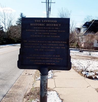
The district reflects the architectural development of the community from village to city through the early 19th and 20th centuries.
It speaks eloquently of our heritage and provides an enduring touchstone by which we may experience our past.
Erected 2004 by Linwood Historical Society.
Topics. This historical marker is listed in this topic list: Settlements & Settlers.
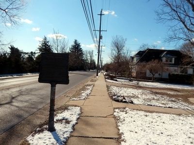
Location. 39° 21.127′ N, 74° 33.921′ W. Marker is in Linwood, New Jersey, in Atlantic County. It is at the intersection of Shore Road and Wilson Avenue on Shore Road. Touch for map. Marker is in this post office area: Linwood NJ 08221, United States of America. Touch for directions.
Regionally, this marker is in the American Northeast, in the Mid-Atlantic, and on the Eastern Seaboard. Globally, it is in the North Atlantic Region, North America, the Western Hemisphere, the Western World, and the Anglosphere. Historically, it finds itself in what was
this page online
Other nearby markers. At least 8 other markers are within 3 miles of this marker, measured as the crow flies: Leedsville Schoolhouse (about 700 feet away, measured in a direct line); Friends Meeting House and Burying Ground (approx. 0.4 miles away); Thomas Morris House (approx. 0.8 miles away); Jeremiah Leeds Grave (approx. 1.1 miles away); Veterans Memorial (approx. 1.4 miles away); Zion United Methodist Church (approx. 1.6 miles away); Submarine Veterans Memorial (approx. 2.7 miles away); U.S. Navy Commandant Richard Somers’ Birthplace (approx. 2.8 miles away). Touch for a list and map of all markers in Linwood.
Credits. This page was last revised on June 16, 2016. It was originally submitted on January 30, 2016, by Don Morfe of Baltimore, Maryland. This page has been viewed 953 times since then and 54 times this year. Photos: 1, 2. submitted on January 30, 2016, by Don Morfe of Baltimore, Maryland. • Bill Pfingsten was the editor who published this page.
