Smithville Lower Village
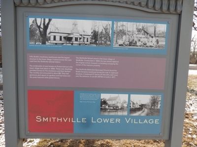
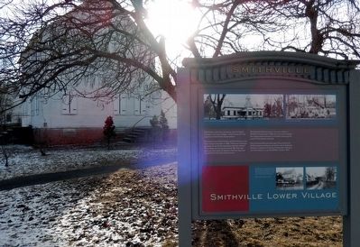
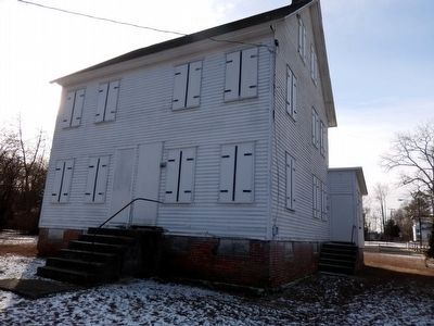
The construction of new houses on Forest Avenue in the lower village took place in 1886. These new dwellings provided homes for the mechanics and their families. The monthly rent amounted to about $8. They had generous yard space for gardens and fruit trees and the yards featured white picket fences. The Smithville School stood in the lower village of Smithville. Constructed in 1899, the new school replaced the original school, housed in a building occupying the corner of the mansion property.
The Smithville Methodist Episcopal Church faced the Smith Company warehouse across the road. A clapboard structure, it measured 27 feet by 37 feet with a bell tower over the entrance. It cost $1,397.84 to build in 1877.
(Inscription under the image in the upper left)
Smithville School, built in the lower village near the pond in 1899.
(Inscription under the image in the upper right)
Smithville school class of 1925.
(Inscription under the image in the lower center)
Left: Back view of a duplex workers’ house on Forest Avenue, about 1925. The houses featured two and one-half story construction. They contained three bedrooms, a living room, dining room and a large kitchen.
Topics. This historical marker is listed in these topic lists: Industry & Commerce • Settlements & Settlers. A significant historical year for this entry is 1886.
Location. 39° 58.874′ N, 74° 44.962′ W. Marker is in Eastampton, New Jersey, in Burlington County. Marker is on Smithville Road. The marker is on the grounds of the Historic Smithville Park. Touch for map. Marker is in this post office area: Mount Holly NJ 08060, United States of America. Touch for directions.
Other nearby markers. At least 8 other markers are within 2 miles of this marker, measured as the crow flies. The Train Station & Smith’s Forest (about 300 feet away, measured in a direct line); An Industrial Village (approx. 0.4 miles away); Smithville Historic District (approx. 0.4 miles away); Historic Smithville Park (approx. 0.4 miles away); The Battle of Iron Works Hill (approx. 1.9 miles away); Battle of Ironworks Hill (approx. 2 miles away); Fire Company (approx. 2.1 miles away); History of Millstone Park (approx. 2.1 miles away). Touch for a list and map of all markers in Eastampton.
Credits. This page was last revised on June 16, 2016. It was originally submitted on February 3, 2016, by Don Morfe of Baltimore, Maryland. This page has been viewed 261 times since then and 8 times this year. Photos: 1, 2, 3. submitted on February 3, 2016, by Don Morfe of Baltimore, Maryland. • Bill Pfingsten was the editor who published this page.


