Collinsville in Canton in Hartford County, Connecticut — The American Northeast (New England)
Collinsville, Town of Canton
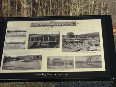
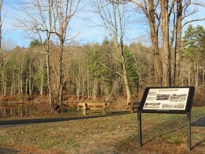
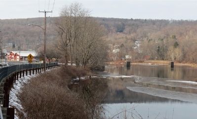
Viewing Site on the River
Note: The house in back was lost in the flood of 1955
Ice on the river, Circa 1900
View of the river from the tracks, Circa 1910
Station, circa 1911, located along the bend of the river
approximately where the cannon now stands with a hotel next door.
Station and boardwalk along the tracks, Circa 1911
Tracks ran along side the river.
Flood of 1955- Site of present-day kayak and canoe shop.
Note: Used grindstones which are used in foundations throughout Collinsville.
Topics. This historical marker is listed in these topic lists: Disasters • Industry & Commerce • Railroads & Streetcars • Sports. A significant historical year for this entry is 1900.
Location. 41° 48.943′ N, 72° 55.242′ W. Marker is in Canton, Connecticut, in Hartford County. It is in Collinsville. Marker is on River Road (Connecticut Route 179), on the left when traveling north. The marker is next to the Farmington River Trail. Park near 41 Bridge Street and walk 0.4 miles north on the Trail to the marker which will be on the right. Touch for map. Marker is in this post office area: Canton CT 06019, United States of America. Touch for directions.
Other nearby markers. At least 8 other markers are within walking distance of this marker. Canton Veterans Memorial (approx. ¼ mile away); a different marker also named Collinsville, Town of Canton (approx. 0.3 miles away); a different marker also named Collinsville (approx. 0.3 miles away); Charter Oak Offspring (approx. 0.3 miles away); Canton Soldiers Memorial (approx. 0.4 miles away); The Collins Company Plow Building (approx. 0.4 miles away); Collinsville’s Powerhouse Station No. 3 (approx. half a mile away); Constitution Oak (approx. 0.7 miles away). Touch for a list and map of all markers in Canton.
Also see . . . Collinsville, Connecticut. (Submitted on February 4, 2016, by Alan M. Perrie of Unionville, Connecticut.)
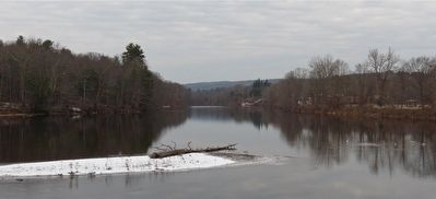
Photographed By Alan M. Perrie, November 20, 2015
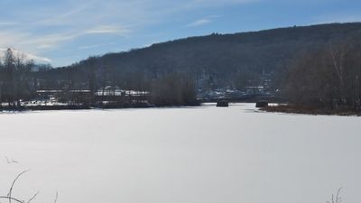
4. Over 100 years of river recreation
The Canton Canoe Club house was washed away in the Flood of 1955. They were followed by the Farmington River Water Ski Club which operated from the early 1960’s to circa 2005. The Simsbury crew team began here in the mid 1970’s. Today you will see a wide variety of canoes, kayaks, and paddle boards.
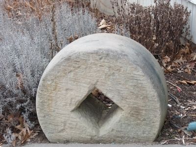
Photographed By Alan M. Perrie, February 1, 2016
6. The used grindstones are abundant
The stone grinding wheels for the Collins Company came from Nova Scotia and were originally 4-8 feet in diameter, weighing 2,000-4,000 pounds. After they were used for sharpening tools, they were used for foundations and erosion control.
Credits. This page was last revised on July 30, 2023. It was originally submitted on February 4, 2016, by Alan M. Perrie of Unionville, Connecticut. This page has been viewed 447 times since then and 16 times this year. Photos: 1, 2, 3, 4, 5, 6. submitted on February 4, 2016, by Alan M. Perrie of Unionville, Connecticut. • Bill Pfingsten was the editor who published this page.
