Near Nelson in Clark County, Nevada — The American Mountains (Southwest)
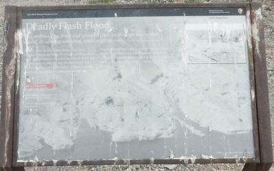
Deadly Flash Flood
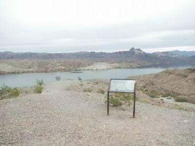
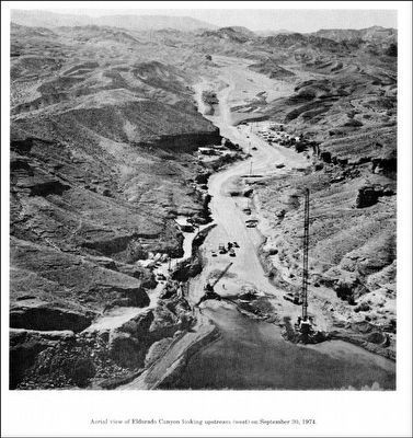
On September 14, 1974, a flash flood roared down Eldorado Canyon and swept the Nelson's Landing marina, which was down below you, into Lake Mohave. Forty-one people escaped in time, but nine others downed. The (?) foot-high wave carries 38 vehicles, 23 boats, boat slips, trailers, cabins, a restaurant, and a store into the lake.
"The cloudburst didn't move over canyon in a normal pattern," said Murl Emery a boating guide, "if followed the line of the stream and moved right down the landing." The U.S. Geological Survey said 5.12 inches of rain fell in the canyon that day.
Safety Precautions
Be alert for changes in weather.
Do not hike in washes if there are thunderstorms in the area.
Head for high ground if a flash flood occurs.
Erected by Department of the Interior National Park Service.
Topics. This historical marker is listed in this topic list: Disasters. A significant historical date for this entry is September 14, 1974.
Location. 35° 42.51′ N, 114° 42.642′ W. Marker is near Nelson, Nevada, in Clark County. Marker is on Nevada Route 165 near Old Nelson's Landing Road, on the right when traveling east. Touch for map. Marker is in this post office area: Searchlight NV 89046, United States of America. Touch for directions.
Other nearby markers. At least 6 other markers are within 14 miles of this marker, measured as the crow flies. El Dorado Canyon (approx. 5.2 miles away); Techatticup Mine (approx. 5.2 miles away); Queho's Cave (approx. 5.2 miles away); a different marker also named El Dorado Canyon (approx. 6˝ miles away); Explore Lake Mead (approx. 13.1 miles away in Arizona); Taming the Colorado (approx. 13.1 miles away in Arizona).
More about this marker. This marker is locate at the turn-around at the eastern end of Nevada Highway 165.
Also see . . . Beware Floods in the Driest State. The normally dry canyon turned deadly after an intense hail and rainstorm dumped three inches of rain in just 30 minutes in the mountains up-canyon. The muddy torrent crushed the restaurant, grocery store, and bar in about five seconds. Bernie Daniels, a tourist from Glendale, California, remembered, "Heavy hail fell for 15 minutes. Then there was a solid gush. It had to be 30 or 40 feet high." (Submitted on February 4, 2016, by Barry Swackhamer of Brentwood, California.)
Credits. This page was last revised on June 16, 2016. It was originally submitted on February 4, 2016, by Barry Swackhamer of Brentwood, California. This page has been viewed 1,430 times since then and 129 times this year. Photos: 1, 2, 3. submitted on February 4, 2016, by Barry Swackhamer of Brentwood, California.


