Montegut in Terrebonne Parish, Louisiana — The American South (West South Central)
Montegut School
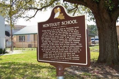
Photographed by Cajun Scrambler, February 19, 2016
1. Montegut School Marker
Erected by Montegut Elementary PTC.
Topics. This historical marker is listed in
this page online
Location. 29° 28.651′ N, 90° 33.355′ W. Marker is in Montegut, Louisiana, in Terrebonne Parish. It is on Montegut Rd. (State Highway 55) near S. Legion Rd, on the left when traveling south. Touch for map. Marker is at or near this postal address: 1137 Highway 55, Montegut LA 70377, United States of America. Touch for directions.

Regionally, this marker is in Louisiana’s Acadiana — Cajun Country and specifically in Bayou Country. It is also in the American South, specifically in the Deep South, and on the Gulf Coast. Globally, it is in North America, a Gulf of Mexico state, the Western Hemisphere, the Western World, and the Anglosphere. Historically, it finds itself in what was once New Spain, Acadia, the territory of the Mississippian Culture, the Louisiana Purchase, one of the Confederate States of America, and the Antebellum South.
Other nearby markers. At least 8 other markers are within 12 miles of this marker, measured as the crow flies: Sacred Heart Church (approx. 0.2 miles away); "Hello Baby!" (approx.
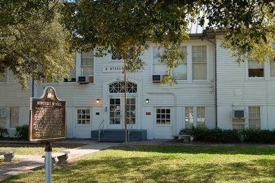
Photographed by Cajun Scrambler, February 19, 2016
2. Montegut School and Marker

February 19, 2016
3. Montegut School
Credits. This page was last revised on November 24, 2022. It was originally submitted on February 21, 2016. This page has been viewed 905 times since then and 53 times this year. Photos: 1, 2, 3. submitted on February 21, 2016. • J. J. Prats was the editor who published this page.
