M2 Bradley Fighting Vehicle
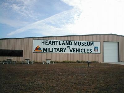
Heartland Museum of Military Vehicles
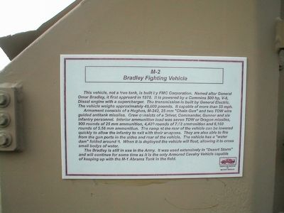
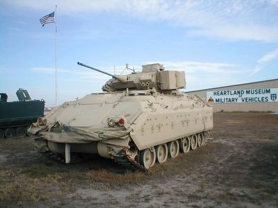
Armament consists of Hughes, M-242, 25 mm “Chain Gun” and two TOW wire guided antitank missiles. Crew consists of Driver, Commander, Gunner and six infantry personnel. Interior ammunition load was seven TOW or Dragon missiles, 900 rounds of 25 mm ammunition, 4,400 rounds of 7.62 ammunition and 6,160 rounds of 5.56 ammunition. The ramp at the rear of the vehicle can be lowered quickly to allow the infantry to exit with their weapons. They are also able to fire from the gun ports in the sides and rear of the vehicle. The vehicle has a “water dam” folded around it. When it is deployed the vehicle will float, allowing it to cross small bodys of water.
The Bradley is still in use in the Army. It was used extensively in “Desert Storm” and will continue for some time as
this page online
Erected by Heartland Museum of Military Vehicles.
Topics. This historical marker is listed in this topic list: War, 1st Iraq & Desert Storm.
Location. 40° 44.559′ N, 99° 44.271′ W. Marker is in Lexington, Nebraska, in Dawson County. It is on Heartland Road. The museum is near I-80, Exit 237. Touch for map. Marker is at or near this postal address: 606 Heartland Road, Lexington NE 68850, United States of America. Touch for directions.

Regionally, this marker is in Central Nebraska and in the Platte River Valley. It is also in the American Midwest, in the Corn Belt, and on the prairies. Globally, it is in North America, the Western Hemisphere, the Western World, and the Anglosphere. Historically, it finds itself in what was once the Louisiana Purchase.
Other nearby markers. At least 8 other markers are within 9 miles of this marker, measured as the crow flies: M60A1 Main Battle Tank (within shouting distance of this marker); Plum Creek Railroad Attack (approx. 5 miles
Other markers no longer nearby. The Plum Creek Massacre (was approx. 8.4 miles away but has been replaced with another marker now near it); Plum Creek Massacre Site (was approx. 8.4 miles away but has been replaced with another marker now near it).
Credits. This page was last revised on June 16, 2016. It was originally submitted on February 22, 2016, by Don Morfe of Baltimore, Maryland. This page has been viewed 906 times since then and 63 times this year. Photos: 1, 2, 3, 4. submitted on February 22, 2016, by Don Morfe of Baltimore, Maryland. • Bill Pfingsten was the editor who published this page.
