Galliano in Lafourche Parish, Louisiana — The American South (West South Central)
Galliano
Circa 1830's
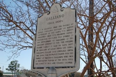
Photographed by Cajun Scrambler, February 19, 2016
1. Galliano Marker
Topics. This historical marker is listed in this topic list: Settlements & Settlers. A significant historical year for this entry is 1832.
Location. 29° 26.04′ N, 90° 17.875′ W. Marker is in Galliano, Louisiana, in Lafourche Parish. It is at the intersection of West Main Street (State Highway 1) and Rusty Eymard Parkway, on the right when traveling south on West Main Street. Touch for map. Marker is in this post office area: Galliano LA 70354, United States of America. Touch for directions.

Regionally, this marker is in one of Louisiana’s River Parishes, in Acadiana — Cajun Country, and specifically in Bayou Country.
this page online
Other nearby markers. At least 8 other markers are within 14 miles of this marker, measured as the crow flies: Golden Meadow (approx. 3.3 miles away); Golden Meadow High School (approx. 3.7 miles away); Cote Blanche (approx. 5.9 miles away); Curole House (approx. 6 miles away); Larose (approx. 9.8 miles away); Our Lady of the Rosary Catholic Church (approx. 10.8 miles away); Leeville Cemetery (approx. 13.1 miles away); Leeville (approx. 13.2 miles away).
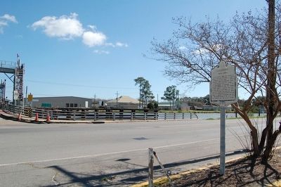
Photographed by Cajun Scrambler, February 19, 2016
2. Galliano Marker
Credits. This page was last revised on July 4, 2024. It was originally submitted on February 23, 2016. This page has been viewed 1,331 times since then and 92 times this year. Photos: 1, 2. submitted on February 23, 2016. • Bernard Fisher was the editor who published this page.
