Correctionville in Woodbury County, Iowa — The American Midwest (Upper Plains)
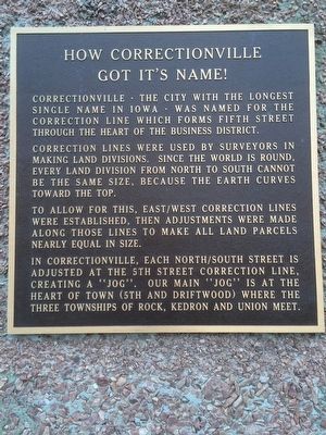
How Correctionville Got Its Name!
Photographed by Ruth VanSteenwyk, February 21, 2016
1. How Correctionville Got It's Name! Marker
Correction lines were used by surveyors in making land divisions. Since the world is round, every land division from north to south cannot be the same size, because the Earth curves toward the top.
To allow for this, east/west correction lines were established, then adjustments were made along those lines to make all land parcels nearly equal in size.
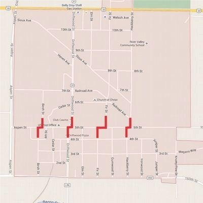
In Correctionville, each North/South street is adjusted at the 5th Street correction line, creating a “Jog.” Our Main “Jog” is at the heart of town (5th and Driftwood) where the three townships of Rock, Kedron and Union meet.
Topics. This historical marker is listed in this topic list: Settlements & Settlers.
Location. 42° 28.492′ N, 95° 47.144′ W. Marker is in Correctionville, Iowa, in Woodbury County. It is at the intersection of 5th Street and Driftwood Street, on the right when traveling east on 5th Street.
this page online

Regionally, this marker is in Western Iowa and in Loess Hills. It is also in the American Midwest, in the Lewis & Clark Corridor, and in the Corn Belt. Globally, it is in North America, the Western Hemisphere, the Western World, and the Anglosphere. Historically, it finds itself in what was once the territory of the Mississippian Culture and also the Louisiana Purchase.
Other nearby markers. At least 8 other markers are within 12 miles of this marker, measured as the crow flies: Built for a Lifetime of Service (approx. 0.2 miles away); Veteran's Memorial (approx. 0.2 miles away); Correctionville's Engine for Growth (approx. 0.6 miles away); Strong, Simple and Economical (approx. 0.6 miles away); Russ Dixon (approx. ¾ mile away); Woodbury County Freedom Rock Veterans Memorial (approx. 7.1 miles away); Theobald Subwatershed (approx. 10.1 miles away); Kingsley Freedom Rock Veterans Memorial (approx. 11.9 miles away). Touch for a list and map of all markers in Correctionville.
More about this marker.
Photographed by Ruth VanSteenwyk, February 21, 2016
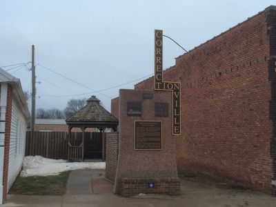
2. How Correctionville Got It's Name! Marker Spot
Also see . . . Vintage Photographs of Correctionville. (Submitted on March 5, 2016, by J. J. Prats of Powell, Ohio.)
Photographed by Google Maps
3. Correctionville Map Showing the 5th Street “Jogs”
Credits. This page was last revised on June 16, 2016. It was originally submitted on February 29, 2016, by Ruth VanSteenwyk of Aberdeen, South Dakota. This page has been viewed 5,657 times since then and 395 times this year. It was the Marker of the Week March 6, 2016. Photos: 1, 2. submitted on February 29, 2016, by Ruth VanSteenwyk of Aberdeen, South Dakota. 3. submitted on March 5, 2016, by J. J. Prats of Powell, Ohio. • Bill Pfingsten was the editor who published this page.
