West Chester in Chester County, Pennsylvania — The American Northeast (Mid-Atlantic)
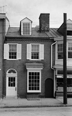
Historic American Structure
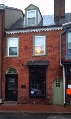
on East Gay Street in
— West Chester, (once called Turk's Head) Pennsylvania —
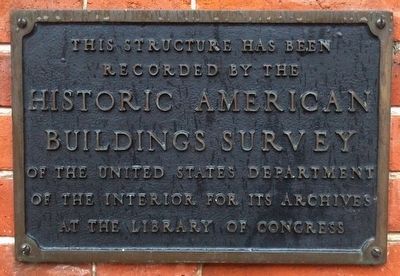
recorded by the
HISTORIC AMERICAN
BUILDINGS SURVEY
of the United States Department
of the Interior for its Archives
at the Library of Congress
Erected by Library of Congress - United States Department of the Interior.
Topics. This historical marker is listed in these topic lists: Architecture • Colonial Era.
Location. 39° 57.686′ N, 75° 36.174′ W. Marker is in West Chester, Pennsylvania, in Chester County. Marker is on East Gay Street, on the left when traveling west. Touch for map. Marker is at or near this postal address: 130 E Gay St, West Chester PA 19380, United States of America. Touch for directions.
Other nearby markers. At least 8 other markers are within walking distance of this marker. Historic West Chester, Pennsylvania Building (here, next to this marker); G. Raymond Rettew (about 500 feet away, measured in a direct line); The Dime Savings Bank (about 600 feet away); Turk’s Head Tavern (about 600 feet away); William Darlington (about 600 feet away); Bank of Chester County (about 700 feet away); William Darlington M.D. (about 700 feet away); The First National Bank of West Chester (about 700 feet away). Touch for a list and map of all markers in West Chester.
Also see . . . Treasure Trove found in ceiling. (Submitted on March 7, 2016, by Keith S Smith of West Chester, Pennsylvania.)
Credits. This page was last revised on December 26, 2020. It was originally submitted on March 2, 2016, by Keith S Smith of West Chester, Pennsylvania. This page has been viewed 361 times since then and 17 times this year. Photos: 1, 2. submitted on March 2, 2016, by Keith S Smith of West Chester, Pennsylvania. 3. submitted on May 12, 2016, by Keith S Smith of West Chester, Pennsylvania. • Bill Pfingsten was the editor who published this page.


