Dayton in Montgomery County, Ohio — The American Midwest (Great Lakes)
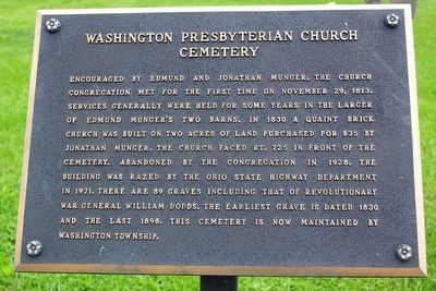
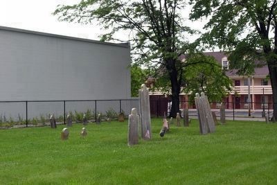
Washington Presbyterian Church Cemetery
Topics. This historical marker is listed in these topic lists: Cemeteries & Burial Sites • Churches & Religion. A significant historical date for this entry is November 29, 1813.
Location. Marker has been reported missing. It was located near 39° 38′ N, 84° 12.371′ W. Marker was in Dayton, Ohio, in Montgomery County. Marker was at the intersection of Washington Church Road and Miamisburg Centerville Road (U.S. 725), on the left when traveling south on Washington Church Road. Touch for map. Marker was in this post office area: Dayton OH 45459, United States of America. Touch for directions.
Other nearby markers. At least 8 other markers are within 4 miles of this location, measured as the crow flies. Mad River Road / Road From Cunningham's to Mad River (approx. 0.6 miles away); Brigadier General Edmund Munger (approx. 2.2 miles away); Centerville Veterans Memorial (approx. 2.4 miles away); Miamisburg (approx. 2˝ miles away); Sugar Creek Baptist Church Cemetery (approx. 2.6 miles away); Woody's Market (approx. 3˝ miles away); The Wright Seaplane Base / Wright Model G "Aeroboat" (approx. 3.6 miles away); Wright Model G Seaplane (approx. 3.6 miles away).
Also see . . . Washington Cemetery - findagrave.com. (Submitted on March 7, 2016.)
Additional commentary.
1. Removal of Marker
Improvements were made to the cemetery in 2011 including the removal of the fences along Washington Church Road and State Route 725 and the construction of a community sign and planter at the northwest corner of the intersection. At that time the marker was removed, and as of November 2015, the marker has not been relocated or replaced.
— Submitted March 7, 2016.
Credits. This page was last revised on June 16, 2016. It was originally submitted on March 7, 2016, by Duane Hall of Abilene, Texas. This page has been viewed 564 times since then and 21 times this year. Photos: 1, 2, 3, 4. submitted on March 7, 2016, by Duane Hall of Abilene, Texas.


