Northside near Jacksonville in Duval County, Florida — The American South (South Atlantic)
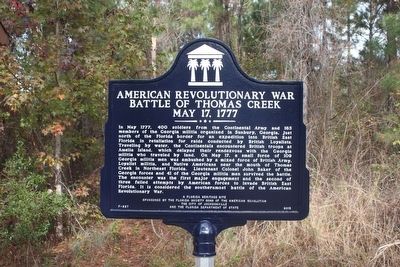
American Revolutionary War Battle of Thomas Creek
May 17, 1777
Inscription.
In May 1777, 400 soldiers from the Continental Army and 165 members of the Georgia militia organized in Sunbury, Georgia, just north of the Florida border for an expedition into British East Florida in retaliation for raids conducted by British Loyalists. Traveling by water, the Continentals encountered British troops at Amelia Island, which delayed their rendezvous with the Georgia militia who traveled by land. On May 17, a small force of 109 Georgia militia men was ambushed by a mixed force of British Army, Loyalist militia, and Native Americans near the mouth of Thomas Creek in Northeast Florida. Lieutenant Colonel John Baker of the Georgia forces and 41 of the Georgia militia men survived the battle. The encounter was the first major engagement and the second of three failed attempts by American forces to invade British East Florida. It is considered the southernmost battle of the American Revolutionary War.
Erected 2015 by The Florida Society Sons of the American Revolution, The City of Jacksonville and the Florida Department of State. (Marker Number F-827.)
Topics. This historical marker is listed in this topic list: War, US Revolutionary. A significant historical date for this entry is May 17, 1777.
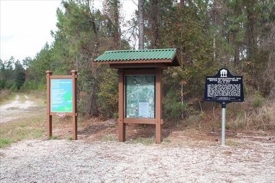
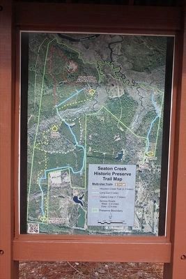
Location. 30° 31.318′ N, 81° 40.139′ W. Marker is near Jacksonville, Florida, in Duval County. It is in Northside. Marker is on Arnold Road, half a mile west of Pecan Park Road, on the right when traveling west. Marker is located in the parking area of the Seaton Creek Historic Preserve. Touch for map. Marker is at or near this postal address: 2145 Arnold Road, Jacksonville FL 32218, United States of America. Touch for directions.
Other nearby markers. At least 8 other markers are within 4 miles of this marker, measured as the crow flies. Marines and Navy FMF Corpsmen (approx. 3.4 miles away); Korean War Memorial (approx. 3.4 miles away); Pearl Harbor (approx. 3.4 miles away); Vietnam War Memorial (approx. 3.4 miles away); Leatherneck Legacy Monument (approx. 3.4 miles away); Address by President Lincoln (approx. 3.4 miles away); Navy Seabees (approx. 3.4 miles away); The Carillon (approx. 3.4 miles away). Touch for a list and map of all markers in Jacksonville.
Related markers. Click here for a list of markers that are related to this marker.
Credits. This page was last revised on February 3, 2023. It was originally submitted on March 16, 2016, by Tim Fillmon of Webster, Florida. This page has been viewed 1,044 times since then and 71 times this year. Photos: 1, 2, 3. submitted on March 16, 2016, by Tim Fillmon of Webster, Florida. • Bernard Fisher was the editor who published this page.


