Dundee in Polk County, Florida — The American South (South Atlantic)
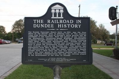
The Railroad in Dundee History
Photographed by Tim Fillmon, December 24, 2014
1. The Railroad in Dundee History Marker
Erected 2001 by The Dundee Depot Restoration Committee and the Florida Department of State. (Marker Number F-458.)
Topics. This historical marker is listed in this topic list: Railroads & Streetcars. A significant historical year for this entry is 1912.
Location. 28° 1.334′ N,
this page online

Regionally, this marker is in Central Florida. It is also in the American South. Globally, it is in the North Atlantic Region, North America, a Gulf of Mexico state, the Western Hemisphere, the Western World, and the Anglosphere. Historically, it finds itself in what was once New Spain, the territory of the Mississippian Culture, one of the Confederate States of America, and the Antebellum South.
Other nearby markers. At least 8 other markers are within 6 miles of this marker, measured as the crow flies: Chief Chipco (approx. 1.8 miles away); 600 E. Hinson Avenue (approx. 5.9 miles away); Florence Villa Training School (approx. 5.9 miles away); 19 N. Sixth Street (approx. 5.9 miles away); Consolidated Arcade (approx. 5.9 miles away); Haines City Masonic Lodge (approx. 5.9 miles away);
Photographed by Tim Fillmon, December 24, 2014
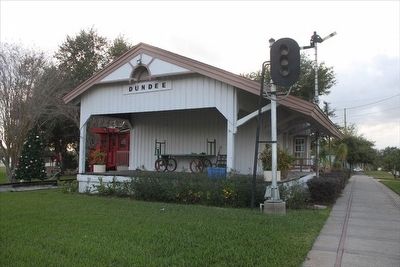
2. The Railroad in Dundee History Depot
Marker is just out of the picture on the right along Main Street. View looking west.
Credits. This page was last revised on June 16, 2016. It was originally submitted on March 22, 2016, by Tim Fillmon of Webster, Florida. This page has been viewed 807 times since then and 62 times this year. Photos: 1, 2. submitted on March 22, 2016, by Tim Fillmon of Webster, Florida. • Bernard Fisher was the editor who published this page.
