Delaware in Delaware County, Ohio — The American Midwest (Great Lakes)
Cornstalk's Visit and the Negotiators' Escape
Inscription.
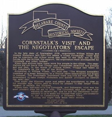
In the late days of September, 1776, negotiators William Wilson and Joseph Nicholson left Fort Pitt which is today Pittsburgh. Their goal was to convince the tribes north and west of the Ohio not to join forces with the British. For support, the negotiators were accompanied by Cornstalk and other Indians.
When they arrived here there were few people in the village. The negotiators did not know that Pluggy and Commander Hamilton had already met and that, in the words of William Wilson, "Pluggy had taken up the tomahawk on the side of the British."
According to William Wilson, the next day, "The Mingoes assembled together at a home belonging to a French smith (blacksmith) and began to counsel. The Frenchman overheard them and told me that they had determined to take Joseph Nicholson and myself prisoners to Detroit the next day."
That night the Mingoes came and asked the negotiators to stay on for another day. Wilson said he would be pleased to stay longer which seemed to satisfy the Mingoes.
Wilson then, "advised with the Cornstalk, and Delawares, what was the most prudent step for me to take. The Cornstalk said that they only wanted to deceive me: and he and the Delawares recommended to us to make our escape that night, and endeavor to get to Cooshocking, a Delaware Town." During the night they made their escape.
Erected 2008 by TThe Delaware County Historical Society, The Kroger Company, and the National City Bank.
Topics and series. This historical marker is listed in these topic lists: Native Americans • War, US Revolutionary. In addition, it is included in the Ohio, Delaware County Historical Society series list. A significant historical month for this entry is September 1776.
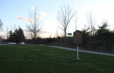
Location. 40° 18.321′ N, 83° 3.74′ W. Marker is in Delaware, Ohio, in Delaware County. Marker is on East Lincoln Avenue near Blymer Street, on the left when traveling east. This marker is situated near the parking lot for a municipal recreational park, that is located about 4 blocks east of the intersection of Sandusky Street (the old U.S. 23) and East Lincoln Avenue. Touch for map. Marker is at or near this postal address: 500 East Lincoln Avenue, Delaware OH 43015, United States of America. Touch for directions.
Other nearby markers. At least 8 other markers are within walking distance of this marker. Site of Pluggy's Town (here, next to this marker); Delaware County War on Terrorism Memorial (approx. 0.4 miles away); Dedicated to the Korea and Vietnam Veterans (approx. 0.4 miles away); Opperation Desert Shield - Desert Storm (approx. 0.4 miles away); Delaware County Civil War Memorial (approx. 0.4 miles away); Co-Founders of Delaware, Ohio

Photographed By Dale K. Benington, March 17, 2016
2. Cornstalk's Visit and the Negotiators' Escape Marker
View of the marker looking north, and in the background is seen a portion of the parking lot for the municipal recreational park (and just beyond the tree-line is the north-bound lane of U.S. 23) .
More about this marker. This marker is situated just north of where Lincoln Avenue ends, at the entrance to a municipal recreational park, that includes the Jack Florance Pool along with several facility buildings. The marker and municipal recreational park are wedged in between U.S. 23 and the Olentangy River.

Photographed By Dale K. Benington, March 17, 2016
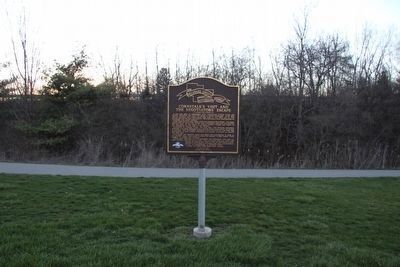
3. Cornstalk's Visit and the Negotiators' Escape Marker
View of the marker looking to the south, and in the distant background is seen the end of East Lincoln Avenue, and the entrance to the municipal recreational park (and beyond that is seen the north-bound lane of U.S. 23).
Credits. This page was last revised on June 16, 2016. It was originally submitted on March 23, 2016, by Dale K. Benington of Toledo, Ohio. This page has been viewed 690 times since then and 31 times this year. Photos: 1, 2, 3, 4. submitted on March 23, 2016, by Dale K. Benington of Toledo, Ohio.

