Arvest Bank
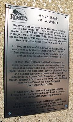
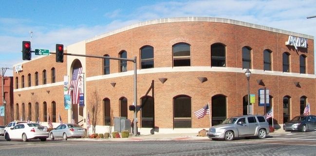
The American National Bank built a new building on this corner in 1962. Prior to that year, it was located at 114 S. First Street and was the only bank in Rogers from 1931 until 1956. The bank was under the leadership of T.E. Harris, and his sons, Lawrence, Ray, and Gene Harris from 1925 until 1975.
In 1964, the name of the American National Bank was changed to the First National Bank. In 1975, Sam Walton and his family acquired the bank, and the new president was Carl Baggett.
In 1981, the First National Bank underwent a major renovation and expansion resulting in the present complex that includes almost the entire block. During this expansion, several older buildings and businesses were acquired and removed including: the Corner Cafe, Shaddox Conoco gas station, Wesner's Grill, and a two story brick building that housed Vance Hill Auto Parks and Jim Tucker Real Estate.
In April 2000, the First National Bank became Arvest Bank. It was started in 1915 and is the only bank that survived the Great Depressions.
After the retirement of Carl Baggett in 1996, Robert Brothers became president where he served until he retired in December 2009 when David Short became the president.
Topics. This historical marker is listed in this topic list: Industry & Commerce. A significant historical year for this entry is 1962.
Location. 36°
Other nearby markers. At least 8 other markers are within walking distance of this marker. Daisy Airgun Museum (within shouting distance of this marker); Victory Theater (about 300 feet away, measured in a direct line); Bank of Rogers (about 500 feet away); First United Methodist Church (about 500 feet away); Applegate Drugstore (about 500 feet away); Harris Baking Company (about 500 feet away); The Butterfield Overland Mail In Arkansas (about 600 feet away); Historic Rogers Post Office Building (approx. 0.2 miles away). Touch for a list and map of all markers in Rogers.
Credits. This page was last revised on March 30, 2021. It was originally submitted on March 26, 2016, by William Fischer, Jr. of Scranton, Pennsylvania. This page has been viewed 538 times since then and 42 times this year. Photos: 1, 2. submitted on March 26, 2016, by William Fischer, Jr. of Scranton, Pennsylvania.

