Near Pescadero in San Mateo County, California — The American West (Pacific Coastal)
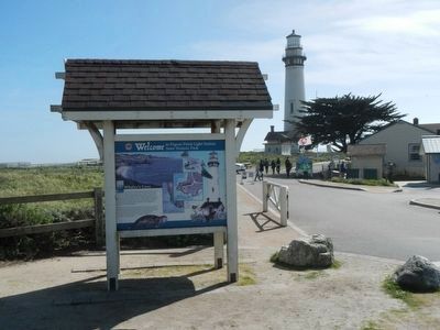
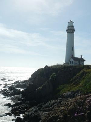
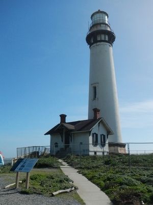
Pigeon Point Light Station State Historic Park
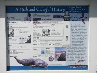
A Rich and Colorful History
Inscription.
Pre-1800s: Ohlone Indians inhabit the coast
Early 1800s: Spanish name Punta de las Balenas - Whale Point
1850s: Clipper ship Carrier Pigeon wrecks on the rocks that are thereafter called Pigeon Point
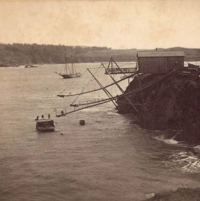
1860: Boom and cable rigged to load lumber and crops onto ships
1862: Loren Coburn and Jeremiah Clarke purchase 17,000 acres that include Pigeon Point
1850s-1895: Portuguese shore whalers kill whales to render and sell whale oil
1868: Congress appropriates $90,000 to establish a lighthouse and prevent more shipwrecks
Early 1870s: Wharf and grain chute built and Pigeon Landing ships goods to San Francisco
1870: U.S. Government purchases Pigeon Point from Coburn and Clarke
1872: Lighthouse erected, first illuminated on November 15, 1872
1875: Gunfight and murder at Pigeon Point Landing over access to the wharf
1899: Original fog signal building replaced with present signal house
1920-33 Rum-running during Prohibition
1972: U.S. Coast Guard replaces the original Fresnel lens with and automated Aero Beacon
1980: U.S. Coast Guard leases Pigeon Point property to California State Parks
1992-93 U.S. Coast Guard renovates the lighthouse
2000: POST purchases Whaler's Cove
2005: Lighthouse transferred to State Parks from U.S. Coast Guard
2005: POST transfers Whaler's Cove to California State Parks for permanent protection.
From the bluffs of Whaler's Cove you see glistening ocean views from Año Nuevo north to Montara Mountain. Harbor seals swim in the cove and sun themselves on Prisoner Rock. Further out you may spot gray whales, blue whales and humpbacks on their winter and spring migrations. Many species of birds are either residents or seasonal visitors. A trip down the sandstone cliffs to the beach reveals the Pigeon Point Formation, which looks like a layer of different types of rocks cemented into the sandstone. The native plants that thrive here add color to the scene while providing food and shelter for local wildlife.
Erected by California State Department of Parks and Recreation.
Topics and series. This historical marker is listed in these topic lists: Disasters • Waterways & Vessels. In addition, it is included in the Lighthouses series list. A significant historical date for this entry is November 15, 1872.
Location. 37° 10.97′ N, 122° 23.608′ W. Marker is near Pescadero, California, in San Mateo County. Marker is on Pigeon Point Road near Cabrillo
Highway (California Route 1), on the right when traveling south. Touch for map. Marker is in this post office area: Pescadero CA 94060, United States of America. Touch for directions.
Other nearby markers. At least 8 other markers are within 5 miles of this marker, measured as the crow flies. Savage Seas (about 300 feet away, measured in a direct line); A Bright Beacon (about 300 feet away); Light Up the Future (about 300 feet away); Pigeon Point Lighthouse (about 400 feet away); a different marker also named Light Up the Future (about 500 feet away); Methodist Episcopal Church of Pescadero (approx. 4.7 miles away); a different marker also named Methodist Episcopal Church of Pescadero (approx. 4.8 miles away); Duarte's Tavern (approx. 4.8 miles away). Touch for a list and map of all markers in Pescadero.
Also see . . . Carrier Pigeon (ship) -- Wikipedia. The cool California Current offshore, enhanced by upwelling of cold sub-surface waters, often creates summer fog near the coast, and June 6, 1853, was no exception. As night approached, so did the fog. The captain of the Carrier Pigeon, Azariah Doane, believed that the ship was far from shore, and so he gave the order to sail eastward toward the shore. In few minutes the clipper hit the rocky bottom. (Submitted on March 27, 2016, by Barry Swackhamer of Brentwood, California.)
Additional keywords. Lighthouse
Credits. This page was last revised on June 16, 2016. It was originally submitted on March 27, 2016, by Barry Swackhamer of Brentwood, California. This page has been viewed 440 times since then and 23 times this year. Photos: 1, 2, 3, 4, 5. submitted on March 27, 2016, by Barry Swackhamer of Brentwood, California.
