Near Harman in Randolph County, West Virginia — The American South (Appalachia)
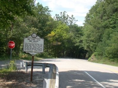
Big Lime and Big Injun

Photographed by J. J. Prats, July 15, 2008
1. Big Lime and Big Injun Marker
Erected 1963 by the West Virginia Historic Commission and sponsored by the W. Va. Centennial Committee of the Oil and Natural Gas industry.
Topics and series. This historical marker is listed in this topic list: Natural Resources. In addition, it is included in the West Virginia Archives and History series list.
Location. 38° 55.683′ N, 79° 31.437′ W. Marker is near Harman, West Virginia, in Randolph County. It is on West Virginia Route 32 north of U.S. 33, on the left when traveling north. It is at the intersection of Main Street extended (County Road 32/5) and Route 32. Touch for map. Marker is in this post office area: Harman WV 26270, United States of America. Touch for directions.

Regionally, this marker is in West Virginia’s Potomac Highlands. It is also in the American South,
this page online
Other nearby markers. At least 8 other markers are within 11 miles of this marker, measured as the crow flies: Veterans Memorial (approx. half a mile away); Tory Camps / Seneca Trail (approx. 2½ miles away); Pendleton County / Randolph County (approx. 3.9 miles away); John Wolford (approx. 5 miles away); In Memory of Michael A. Beckelhimer and Frank H. Conway (approx. 9 miles away); Tuscarora (Clinton) Sand (approx. 10.3 miles away); An 1800’s Garden! (approx. 10.3 miles away); A Melting Pot House (approx. 10.3 miles away). Touch for a list and map of all markers in Harman.
Another marker is no longer nearby. Seneca Rocks (was approx. 10.3 miles away but has been confirmed missing).
Also see . . . Oil and Gas Museum, Parkersburg, WV. “Both oil and natural gas were discovered in western Virginia by the first explorers in the mid-1700s.
Photographed by J. J. Prats, July 15, 2008
2. Big Lime and Big Injun Marker
Credits. This page was last revised on June 9, 2020. It was originally submitted on July 20, 2008, by J. J. Prats of Powell, Ohio. This page has been viewed 3,126 times since then and 115 times this year. Photos: 1, 2. submitted on July 20, 2008, by J. J. Prats of Powell, Ohio.
Editor’s want-list for this marker. Photos of the quarry wall showing what is described on the marker • Can you help?
