Elkins in Randolph County, West Virginia — The American South (Appalachia)
Elkins
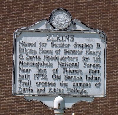
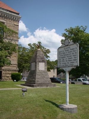
Named for Senator Stephen B. Elkins. Home of Senator Henry G. Davis. Headquarters for the Monongahela National Forest. Near site of Friend’s Fort, built 1772. Old Seneca Indian Trail crosses the campus of Davis and Elkins College.
Topics and series. This historical marker is listed in this topic list: Political Subdivisions. In addition, it is included in the West Virginia Archives and History series list. A significant historical year for this entry is 1772.
Location. 38° 55.362′ N, 79° 50.58′ W. Marker is in Elkins, West Virginia, in Randolph County. Marker is at the intersection of Randolph Avenue (U.S. 33) and High Street, on the right when traveling west on Randolph Avenue. It is at the courthouse. Touch for map. Marker is in this post office area: Elkins WV 26241, United States of America. Touch for directions.
Other nearby markers. At least 8 other markers are within walking distance of this marker. Randolph County Veterans Memorial (a few steps from this marker); “Lest We Forget That Peace Has a Price” (within shouting distance of this marker); Kump House / Herman Guy Kump (approx. 0.3 miles away); Henry Gassaway Davis (approx. 0.4 miles away); The Darden Mill (approx. 0.4 miles away); The Railroad Builds Elkins (approx. half a mile away); Working the Railyard (approx. half a mile away); War in West Virginia (approx. half a mile away). Touch for a list and map of all markers in Elkins.
Also see . . . Elkins - Yesterday and Today. City Website entry:
“The City of Elkins, situated on a bend in the Tygart Valley River, was developed by Senators Henry Gassaway Davis and Stephen B. Elkins and named for Senator Elkins, in 1890. Elkins became the county seat in 1899. They developed railroad lines, coal mines, and timbering. Together, they built the WV Central and Pittsburgh Railway into Elkins and opened a vast territory to industrial development in the late 1899s. As the railroad expanded, Elkins experienced the luxury of train passenger service. In 1930, 18 passenger trains were arriving and leaving Elkins daily.” (Submitted on July 20, 2008.)
Credits. This page was last revised on March 28, 2022. It was originally submitted on July 20, 2008, by J. J. Prats of Powell, Ohio. This page has been viewed 961 times since then and 39 times this year. Photos: 1, 2, 3. submitted on July 20, 2008, by J. J. Prats of Powell, Ohio.


