Canadian in Hemphill County, Texas — The American South (West South Central)
Canadian River Wagon Bridge
Photographed by Bill Kirchner, March 17, 2016
1. Canadian River Wagon Bridge Marker
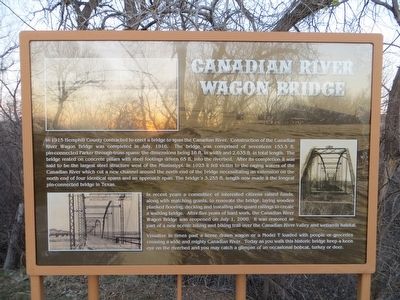
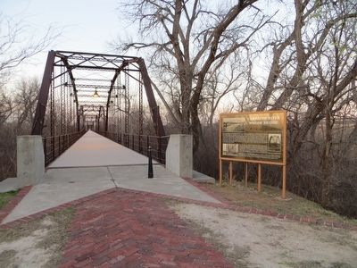
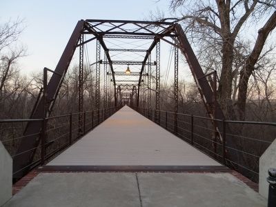
In recent years a committee of interested citizens raised funds, along with matching grants, to renovate the bridge, laying wooden planked flooring, decking, and installing side-guard railings to create a walking bridge. After five years of hard work, the Canadian River Wagon Bridge was reopened on July 1, 2000. It was restored as part of a new scenic hiking and biking trail over the Canadian River Valley and wetlands habitat.
Visualize
this page online
Topics. This historical marker is listed in this topic list: Bridges & Viaducts. A significant historical month for this entry is July 1916.
Location. 35° 56.228′ N, 100° 22.264′ W. Marker is in Canadian, Texas, in Hemphill County. It can be reached from U.S. 60 0.1 miles south of U.S. 83. Marker can be reached by walking 0.2 miles on old road bed, from a parking lot on west side of US-60. Touch for map. Marker is in this post office area: Canadian TX 79014, United States of America. Touch for directions.

Regionally, this marker is on the Texas Panhandle. It is also on the American Great Plains and specifically on the Southern Plains. Globally, it is in North America, a Gulf of Mexico state, the Western Hemisphere, the Western World, and the Anglosphere. Historically, it finds itself in what was once New Spain, the Comanchería, the Dust Bowl, the Republic of Texas,
Photographed by Bill Kirchner, March 17, 2016
2. Canadian River Wagon Bridge Marker
Other nearby markers. At least 8 other markers are within 2 miles of this marker, measured as the crow flies: Canadian River Trails (approx. one mile away); Quanah Parker Trail (approx. one mile away); Hemphill County (approx. one mile away); Robert R. Young (approx. one mile away); Edith Ford Memorial Cemetery (approx. 1.6 miles away); Tom T. McGee (approx. 1.6 miles away); Moody Hotel (approx. 1.7 miles away); First National Bank of Canadian (approx. 1.7 miles away). Touch for a list and map of all markers in Canadian.
Photographed by Bill Kirchner, March 17, 2016
3. Canadian River Wagon Bridge
Photographed by Bill Kirchner, March 17, 2016
4. Canadian River Wagon Bridge
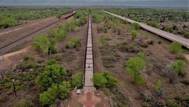
Photographed by Wesley Harris, December 20, 2022
5. Canadian River Wagon Bridge Marker
Credits. This page was last revised on May 18, 2023. It was originally submitted on April 5, 2016, by Bill Kirchner of Tucson, Arizona. This page has been viewed 1,556 times since then and 88 times this year. Photos: 1, 2, 3, 4. submitted on April 5, 2016, by Bill Kirchner of Tucson, Arizona. 5. submitted on May 18, 2023, by Wesley Harris of Ruston, Louisiana.
