Near Walnut Creek in Contra Costa County, California — The American West (Pacific Coastal)
Blackhawk Ranch Quarry
A Paleontological Treasure

Photographed By Barry Swackhamer, April 1, 2016
1. Blackhawk Ranch Quarry Marker
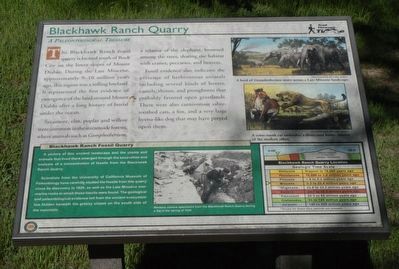
captions: (top right) A herd of Gomphotherium move across a Late Miocene landscape.; (middle right) A saber-tooth cat ambushes a three-toed horse, relative of the modern zebra.; (bottom center) Workers remove specimens from the Blackhawk Ranch Quarry during a dig in the spring of 1938.; (bottom right) Geologic Time Scale.
Sycamore, elm, poplar and willow were common in the streamed forests, where animals such as Gomphotherium, a relative of the elephant, browsed among the trees, sharing the habitat with cranes, peccaries, and beavers.
Fossil evidence also indicates the presence of herbivorous animals including several kinds of horses, camels, rhinos, and pronghorns that probably favored open grasslands. There were also carnivorous sabre-toothed cats, a fox, and a very large hyena-like dog that may have preyed upon them.
A picture of this ancient landscape and the plants and animals that lived there emerged through the excavation and analysis of the concentration of fossils from the Blackhawk Ranch Quarry.
Scientist from the University of California Museum of Paleontology have carefully studied the fossils from this quarry since its discovery in 1926, as well as the Late Miocene non-marine rocks in which these fossils were found. The geological and paleontological evidence left from the ancient ecosystem lies, hidden beneath the grassy slopes on the south side of the mountain.
Erected by Mt Diablo State Park.
Topics. This historical marker is listed in this topic list: Paleontology.
Location. 37° 50.972′ N, 121° 55.948′ W. Marker is near Walnut Creek, California, in Contra Costa County. Marker is on Southgate Road, on the left when traveling south. Touch for map. Marker is in this post office area: Walnut Creek CA 94598, United States of America. Touch for directions.
Other nearby markers. At least 8 other markers are within 3 miles of this marker, measured as the crow flies. Indian Grinding Holes (about 500 feet away, measured in a direct line); Sentinel Rock Overlook (approx. 0.2 miles away); Turritella Snail Bed (approx. 0.2 miles away); Mount Diablo State Park (approx. 2.3 miles away); What Are Those Towers For? (approx. 2.3 miles away); Mt Diablo State Park (approx. 2.4 miles away); Whitegate Farm (approx. 2.4 miles away); Mount Diablo (approx. 2.4 miles away). Touch for a list and map of all markers in Walnut Creek.
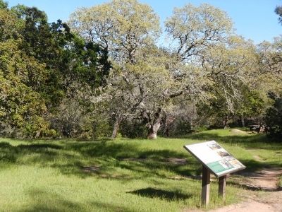
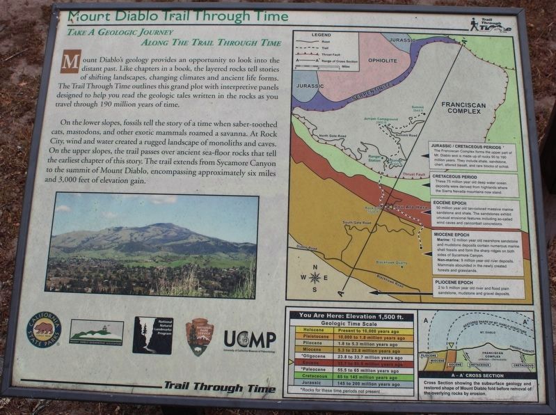
More about this marker. This marker is locate near Rock City on the Trail Through Time.
Also see . . . Black Hawk Ranch Fossil Site - Biohere. This is the type section of fauna of the Montediablan (Black Hawk Ranch) Provincial Mammalian Age which dates from the Clarendonian of the Lower Pliocene. Plant and marine invertebrate fossils from the same epoch have been recovered from the upturned strata here. (Submitted on April 6, 2016, by Barry Swackhamer of Brentwood, California.)
Credits. This page was last revised on June 11, 2022. It was originally submitted on April 5, 2016, by Barry Swackhamer of Brentwood, California. This page has been viewed 1,213 times since then and 123 times this year. Photos: 1. submitted on April 5, 2016, by Barry Swackhamer of Brentwood, California. 2. submitted on April 6, 2016, by Barry Swackhamer of Brentwood, California. 3. submitted on June 8, 2022, by Joseph Alvarado of Livermore, California.

