Mobeetie in Wheeler County, Texas — The American South (West South Central)
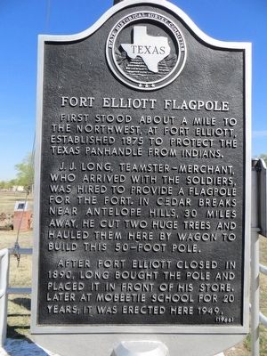
Fort Elliot Flagpole
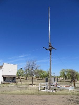
J. J. Long, teamster-merchant, who arrived with the soldiers, was hired to provide a flagpole for the fort. In cedar breaks near Antelope Hills, 30 miles away, he cut two huge trees and hauled them here by wagon to build this 50-foot pole.
After Fort Elliott closed in 1890, Long bought the pole and placed it in front of his store. Later, at Mobeetie school for 20 years; it was erected here 1949.
Erected 1966 by State Historical Survey Committee. (Marker Number 1982.)
Topics. This historical marker is listed in this topic list: Forts and Castles. A significant historical year for this entry is 1875.
Location. 35° 30.617′ N, 100° 26.553′ W. Marker is in Mobeetie, Texas, in Wheeler County. Marker can be reached from Dickerson Street, half a mile south of Texas Highway 152, on the right when traveling south. Marker is at flagpole in front of old jail in Old Mobeetie. Touch for map. Marker is in this post office area: Mobeetie TX 79061, United States of America. Touch for directions.
Other nearby markers. At least 8 other markers are within walking distance of this marker. Emanuel Dubbs (here, next to this marker); Temple Lea Houston (here, next to this marker); Frank Willis, Sr. (here, next to this marker); Captain G. W. Arrington (here, next to this marker); Old Wheeler County Jail, 1886 (a few steps from this marker); Mobeetie (approx. half a mile away); Mobeetie Cemetery (approx. 0.6 miles away); Site of Fort Elliott (approx. one mile away). Touch for a list and map of all markers in Mobeetie.
Credits. This page was last revised on June 16, 2016. It was originally submitted on April 8, 2016, by Bill Kirchner of Tucson, Arizona. This page has been viewed 470 times since then and 26 times this year. Photos: 1, 2. submitted on April 8, 2016, by Bill Kirchner of Tucson, Arizona.

