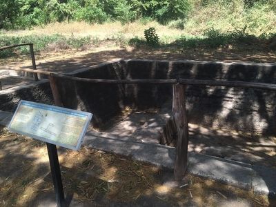
La Paz Centro, León, Nicaragua — Central America
“The Palace of Governor Rodrigo de Contreras”
Colonial Structure No 3
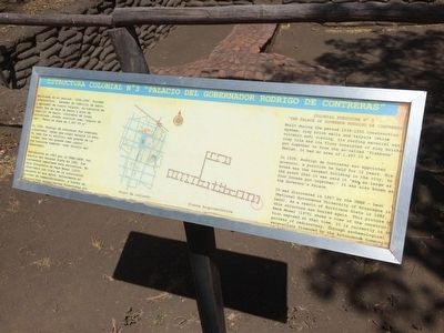
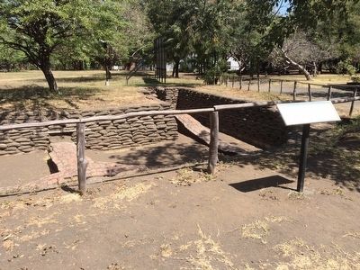
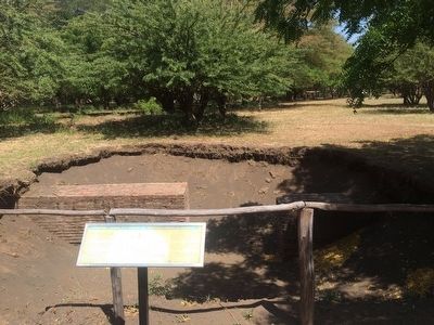
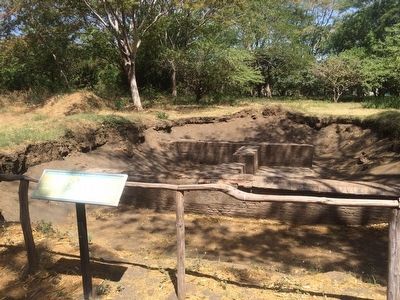
— Estructura Colonial No 3 “Palacio del Governador Rodigo de Contreras” —
Inscription.
Edificada en el periodo 1536-1550. Sistema constructivo: paredes de labrillo de barro y aplanado de tierra talpuja, su cubierta de techo fue de teja de barro y piso de ladrillo de barro, colocados de forma articulada, diseño conocido como “espina de pez”. Tenía un área de 1,457.25 m2.
En 1535, Rodrigo de Contreras fue nombrado gobernador, cargo que ocupó durante 12 años. Su casa fue el edificio más grande de la ciudad “era tan grande como cuatro”. Fue conocida también como Palacio del Gobernador.
Descubierta en 1967 por la UNAN-LEÓN. Por efectos del Huracán Aleta en 1982, fue nuevamente sepultada esta estructura. En esta fotografía de René Moser (1975) observamos una vista de la construcción expuesta en esa época. Actualmente en proceso de redescubrimiento, a través de excavaciones arqueológicas financiadas por la Junta de Andalucía.
Pie de dibujos: Plano de conjunto
Planta Arquitectónica
English:
Colonial Structure No 3
“The Palace of Governor Rodrigo de Contreras”
Built during the period 1536-1550. Construction system: clay brick walls and talpuja (white volcanic ash) coating, its roofing material was clay tile and its floor consisted of clay bricks put together to form the so-called “fishbone” design. It had an area of 1,457.25 m2.
In 1535, Rodrigo de Contreras was appointed governor, a position he held for 12 years. His house was the largest building in the city, to the point that it was said it “was as large as four houses put together.” It was also known as the Governor´s Palace.
It was discovered in 1967 by the UNAN-León (National Autonomous University of Nicaragua in León). As a result of Hurricane Aleta in 1982, this structure was buried again. This picture by René Moser (1975) shows a view of the construction exposed at that time. It is currently in the process of rediscovery, through archaeological excavations financed by the Autonomous Community of Andalusia.
Captions: Site map
Floor plan
Topics. This historical marker is listed in these topic lists: Colonial Era • Government & Politics • Settlements & Settlers. A significant historical year for this entry is 1535.
Location. 12° 24.133′ N, 86° 37.011′ W. Marker is in La Paz Centro, León. The marker is at the León Viejo Archaeological Site, to the north of the site near the town square. Touch for map. Touch for directions.
Other nearby markers. At least 8 other markers are within walking distance of this marker. "The Town Square" (within shouting distance of this marker); “The Saint Mary of Graces Cathedral” (within shouting distance of this marker); “The Town Council” (about 90 meters away, measured in a direct line); "The House of Hernando de Soto and Hernán Ponce de León"
(about 90 meters away); Ruins of Old León (about 90 meters away); "The Royal Road" (about 120 meters away); “The House of Ana Jiménez” (about 120 meters away); "The House of Martín" (about 150 meters away). Touch for a list and map of all markers in La Paz Centro.
Credits. This page was last revised on June 16, 2016. It was originally submitted on April 10, 2016, by J. Makali Bruton of Accra, Ghana. This page has been viewed 346 times since then and 12 times this year. Photos: 1, 2, 3, 4, 5. submitted on April 10, 2016, by J. Makali Bruton of Accra, Ghana.
