Colonial Oaks in Nicholsonboro in Chatham County, Georgia — The American South (South Atlantic)
Nicholsonboro
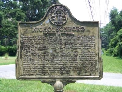
Photographed by Mike Stroud, July 2008
1. Nicholsonboro Marker
When ownership of the lands reverted, 200 former slaves mainly from St. Catherines came here and established their own community in 1868. Ten years later eighteen Negroes signed a mortgage for 200 acres of John Nicholson's land. In four years the thrifty mortgage holders paid the $5,000.00 and received the title in 1882. The community was based upon fishing and farming with Savannah as the primary market. With changes in fishing technology and more stringent city marketing laws, the economic base and the community withered. The primary monument to this community is the Nicholson Baptist Church which had been established with the community. Two early
this page online
Erected 1978 by Georgia Historic Marker. (Marker Number 025-92.)
Topics. This historical marker is listed in these topic lists: African Americans • Notable Places. A significant historical month for this entry is January 1865.
Location. 31° 57.611′ N, 81° 8.221′ W. Marker is in Nicholsonboro, Georgia, in Chatham County. It is in Colonial Oaks. It is at the intersection of Coffee Bluff Road and Old Coffee Bluff Road / Nicholsonboro Circle, on the left when traveling east on Coffee Bluff Road. Touch for map. Marker is in this post office area: Savannah GA 31419, United States of America. Touch for directions.

Regionally, this marker is on the Coastal Plain, on the Georgia Coast and the Golden Isles, and in Greater Savannah. It is also in the American South, specifically in the Deep South, and on the Eastern Seaboard. Globally, it is in the North Atlantic Region, North America, the Western Hemisphere, the Western World, and the Anglosphere. Historically, it finds itself in what was once New Spain, the territory of the Mississippian Culture,
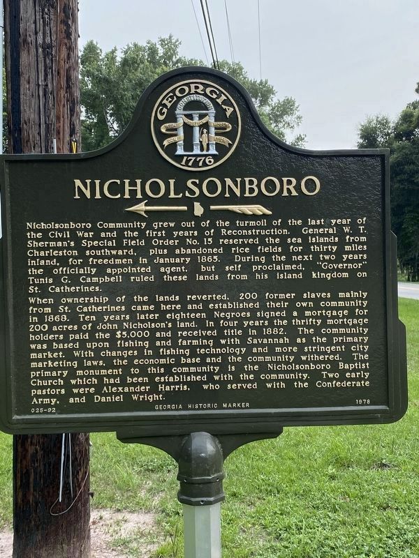
Photographed by Darren Jefferson Clay, June 27, 2020
2. Nicholsonboro marker (restored)
Other nearby markers. At least 8 other markers are within 2 miles of this marker, measured as the crow flies: Vernonburg (approx. 0.8 miles away); Capture of the USS "Water Witch" (approx. 0.9 miles away); White Bluff • Coffee Bluff (approx. 1½ miles away); a different marker also named White Bluff • Coffee Bluff (approx. 1½ miles away); a different marker also named White Bluff • Coffee Bluff (approx. 1½ miles away); White Bluff Meeting House (approx. 1.8 miles away); a different marker also named White Bluff • Coffee Bluff (approx. 1.8 miles away); St. Joseph's Hospital (approx. 2 miles away).
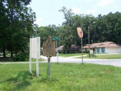
Photographed by Mike Stroud, July 20, 2008
3. Nicholsonboro Marker, arrow points to Nicholsonboro Circle, a housing development
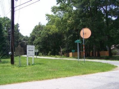
Photographed by Mike Stroud, 2008
4. Nicholsonboro Marker looking south on Coffee Point Road
Marker at left
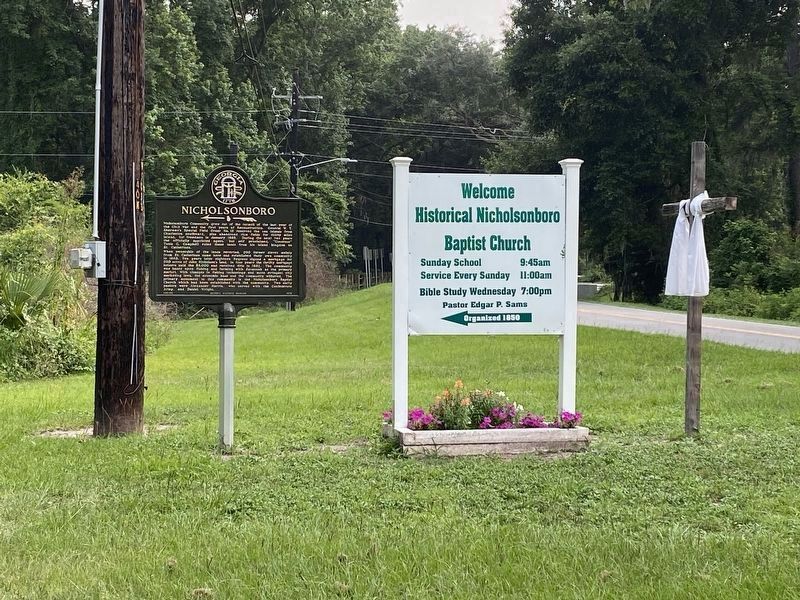
Photographed by Darren Jefferson Clay, June 27, 2020
5. Nicholsonboro marker (restored)
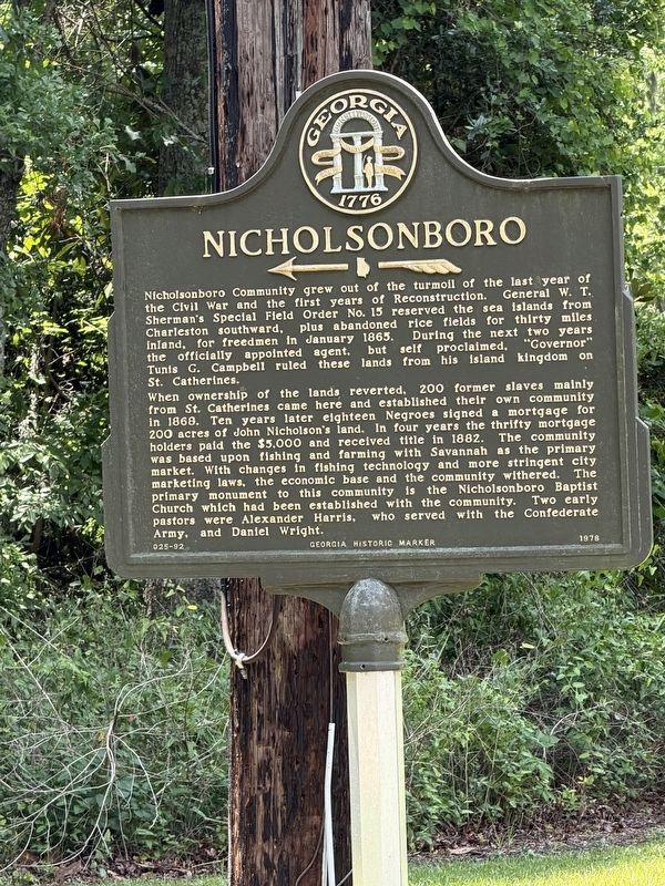
Photographed by George Fielder, May 3, 2026
6. Nicholsonboro Marker
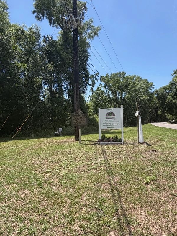
Photographed by George Fielder, May 3, 2026
7. Nicholsonboro Marker and Church Signs
Credits. This page was last revised on May 28, 2026. It was originally submitted on July 21, 2008, by Mike Stroud of Bluffton, South Carolina. This page has been viewed 2,323 times since then and 52 times this year. Photos: 1. submitted on July 21, 2008, by Mike Stroud of Bluffton, South Carolina. 2. submitted on November 10, 2020, by Darren Jefferson Clay of Duluth, Georgia. 3, 4. submitted on July 21, 2008, by Mike Stroud of Bluffton, South Carolina. 5. submitted on November 10, 2020, by Darren Jefferson Clay of Duluth, Georgia. 6, 7. submitted on May 23, 2026, by George Fielder of Bloomingdale, Georgia. • Christopher Busta-Peck was the editor who published this page.
